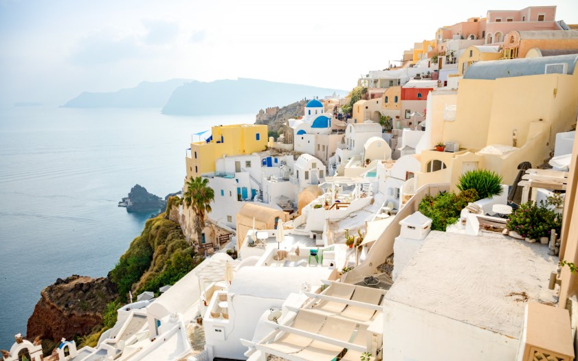
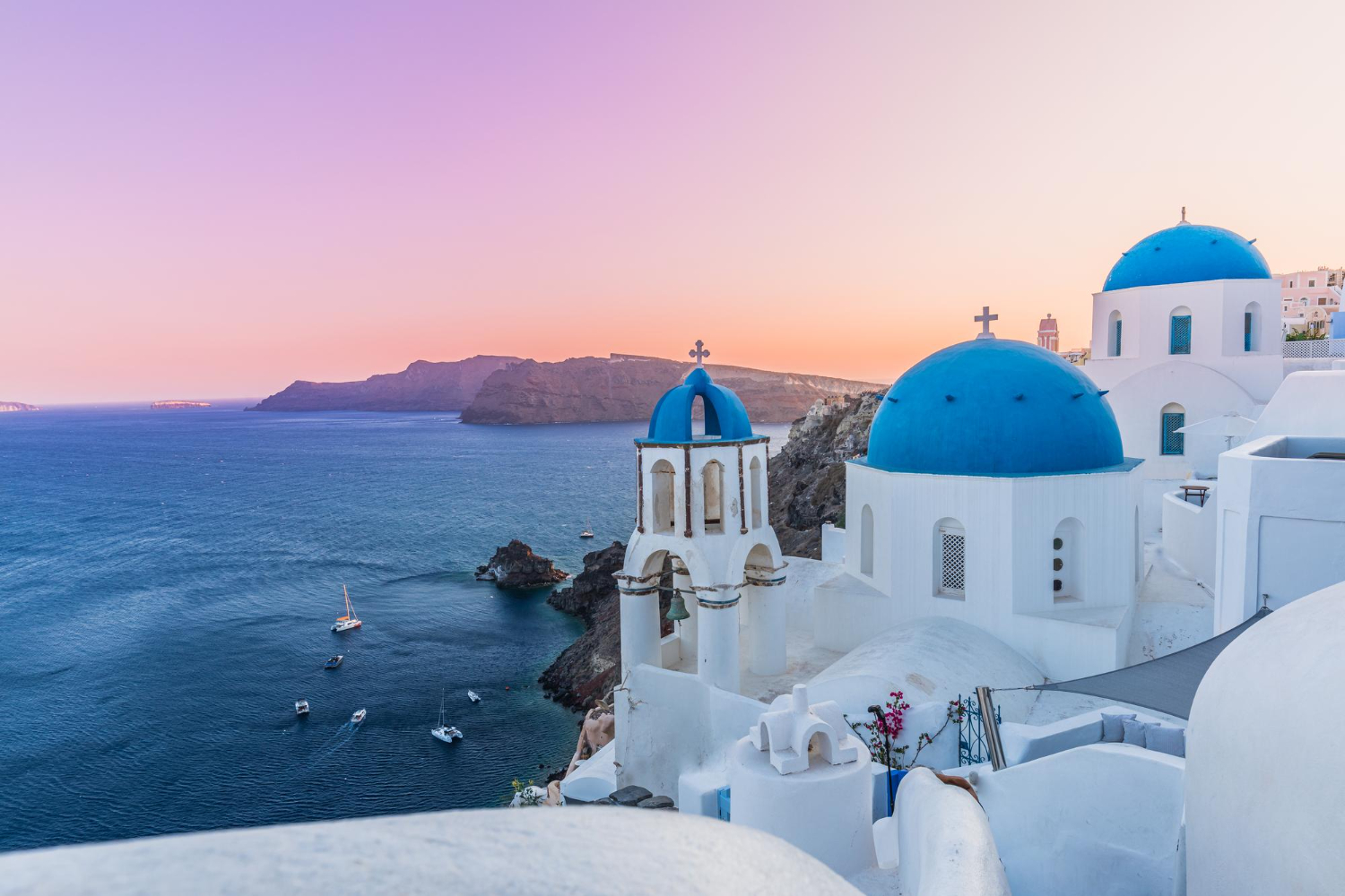
Santorini is one of the world’s most photographed destinations — but most visitors don’t realize they’re standing on the edge of an active volcano. The dramatic white-and-blue villages of Fira, Oia, and Imerovigli sit atop 300-meter cliffs that form the rim of a flooded caldera 12 by 7 kilometers wide. The caldera was formed approximately 3,600 years ago by the Minoan eruption — one of the largest volcanic events in human history. The volcano is still active. Two volcanic islands (Nea Kameni and Palea Kameni) continue forming in the caldera center, with the most recent eruption in 1950 and ongoing seismic activity through 2024-2025. Here’s the actual story.
1: A Volcano in the Aegean Sea
Santorini sits in the southern Aegean Sea, approximately 200 km southeast of mainland Greece and 120 km north of Crete. The main island Santorini (officially “Thira” or “Thera”) covers approximately 73 km² with a 2021 census population of 15,480 residents. The municipality of Santorini includes the main island plus Therasia (inhabited), Nea Kameni and Palea Kameni (uninhabited volcanic islands), Aspronisi, Anydros, and Christiana. Total municipal area: 90 km².
The island isn’t a typical Mediterranean destination — it’s a partially submerged active volcano. The dramatic crescent shape that defines Santorini’s iconic appearance is actually the rim of an enormous caldera that flooded with seawater after the Minoan eruption approximately 3,600 years ago. The cumulative geology produces the cliffs, the beaches of various unusual colors, the layered lava sediments visible in caldera walls, and various other distinctive features that have made Santorini one of the most distinctive Mediterranean destinations.
2: The Geological Reality
Santorini sits at the most active part of the South Aegean Volcanic Arc — chain of active and dormant volcanoes stretching approximately 500 km across the southern Aegean. The volcanic activity is caused by the African tectonic plate subducting beneath the Aegean subplate of the Eurasian tectonic plate at rates up to 5 cm per year. The cumulative tectonic activity has produced volcanic eruptions on Santorini for approximately 2-3 million years.
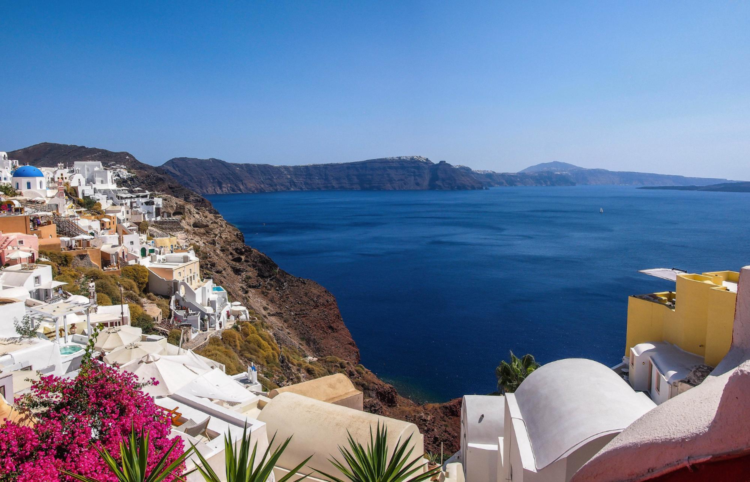
The current caldera measures approximately 12 km by 7 km with maximum depth of 385 m below sea level. The caldera walls rise 300+ meters above sea level on the inner side, creating the dramatic cliffs that define Santorini’s appearance. The cumulative geological formation isn’t single event — at least four major caldera collapses have occurred over the past 350,000 years through Plinian eruptions (dramatic vertical-column eruptions). The current caldera shape resulted from the most recent of these collapses approximately 3,600 years ago.
3: The Minoan Eruption
The defining event in Santorini’s geological history was the Minoan eruption approximately 1,600 BCE (precise dating remains scientifically debated). The cumulative eruption was one of the largest volcanic events in recorded human history, with substantial ash deposits found as far away as Turkey and Egypt. The eruption likely triggered substantial tsunamis throughout the Mediterranean. Various researchers connect the Minoan eruption to the decline of the Minoan civilization on Crete.
The cumulative cultural impact extended substantially beyond direct physical destruction. Some researchers believe stories of “cities drowned by the sea” eventually inspired Plato’s writings about Atlantis several centuries later. The Akrotiri archaeological site on Santorini reveals substantial Bronze Age civilization that existed before the eruption — including multi-story buildings, sophisticated frescoes, and various other elements suggesting significant prehistoric society. The cumulative civilization was essentially preserved beneath ash much like Pompeii would later be preserved by Vesuvius.
4: The Akrotiri Archaeological Site
Akrotiri provides substantial archaeological insight into Bronze Age life on Santorini before the Minoan eruption. The cumulative site reveals Minoan-era town that was buried by volcanic ash, preserving substantial buildings, art, and various other artifacts. Various multi-story structures still stand. Substantial frescoes have been recovered showing elaborate scenes of daily life, religious activities, and various other subjects. The cumulative preservation rivals other Mediterranean archaeological sites in detail and quality.
Modern visitors can access Akrotiri through bioclimatic protective shelter that protects the cumulative archaeological work from weather while permitting visitor access. The site operates from April 1 through October 31 annually. The cumulative experience provides specific connection between the dramatic geological story and the cumulative human history that occurred on Santorini. Various visitors substantially undervalue Akrotiri compared to better-known mainland Greek archaeological sites — but the cumulative preservation quality is genuinely substantial.
5: The Kameni Islands in the Center
After the Minoan eruption created the current caldera, volcanic activity continued at slower pace. The cumulative subsequent eruptions have built two volcanic islands in the caldera center — Palea Kameni (“Old Burnt”) and Nea Kameni (“New Burnt”). Palea Kameni formed around 46-47 CE according to Roman historian Cassius Dio’s records. Nea Kameni formed substantially later through cumulative eruptions across approximately 1,700 years.
Major eruptions over the past 300 years occurred in 1707-1712, 1866-1870, 1925-1928, and 1939-1941. The most recent eruption was in 1950 with substantial lava dome extrusion. The cumulative eruptions have built Nea Kameni into approximately 2-kilometer diameter island with 3.4 km² area. The cumulative volcanic activity continues — both Kameni islands continue venting steam and carbon dioxide from active craters. Nea Kameni in particular continues being actively monitored due to ongoing volcanic potential.
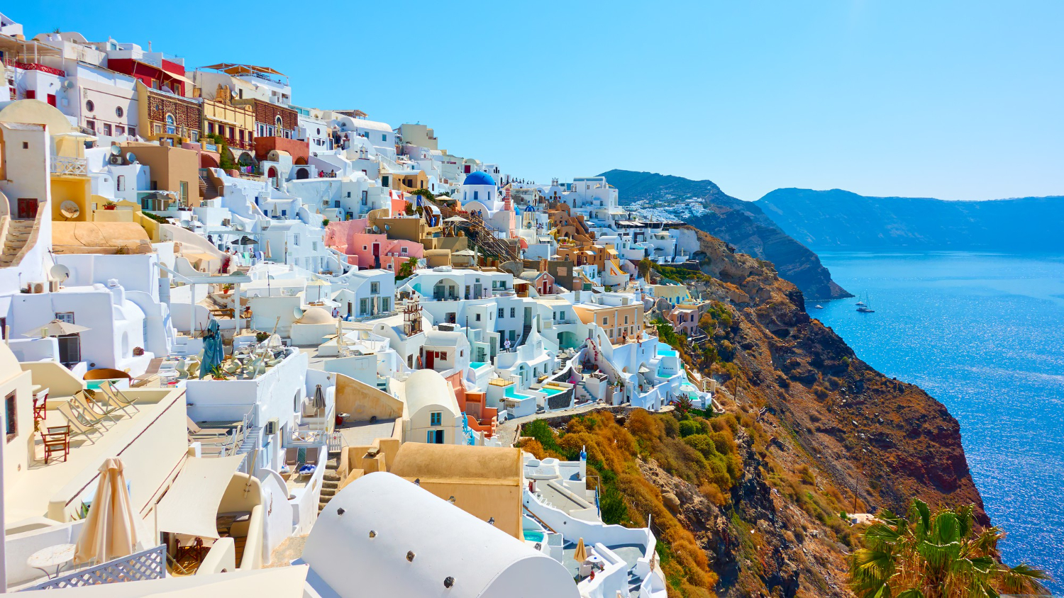
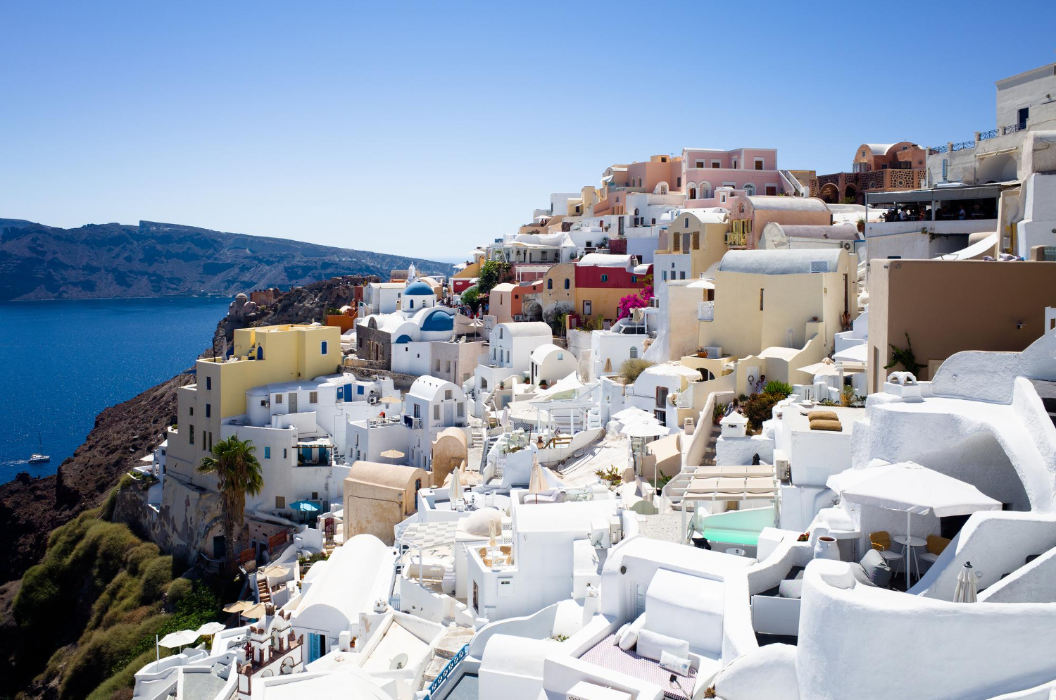
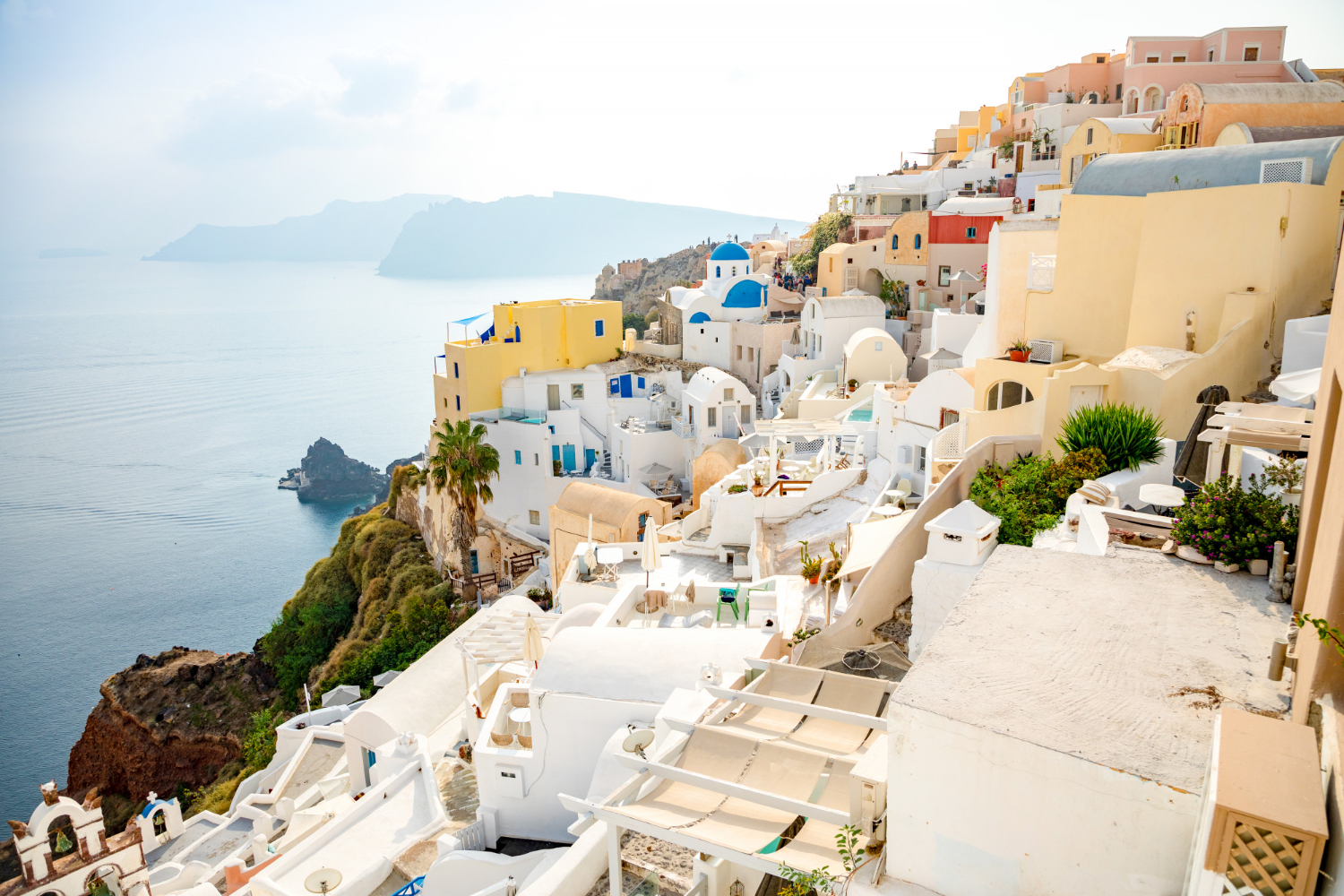
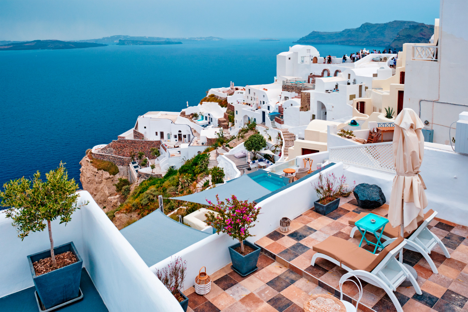
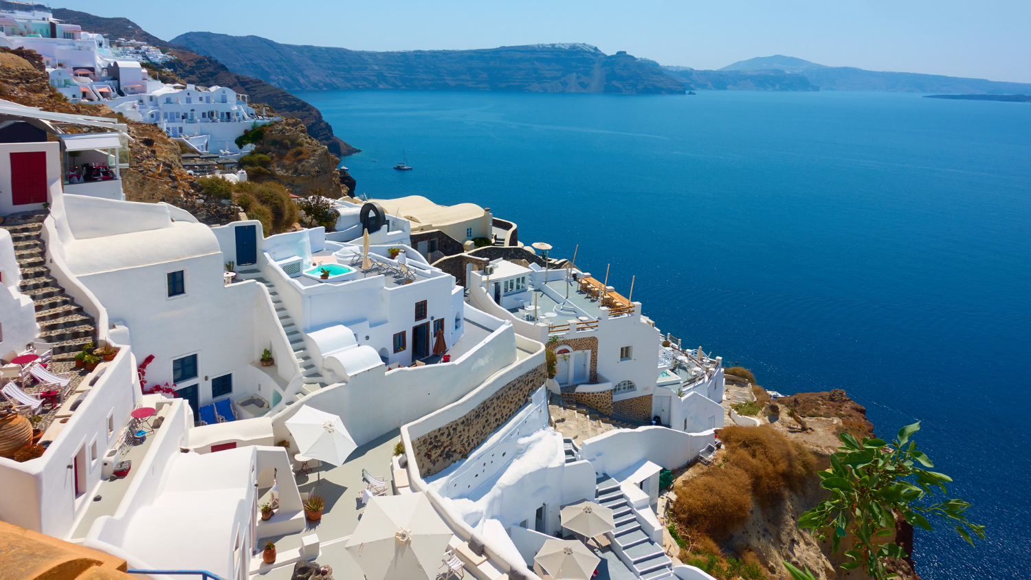
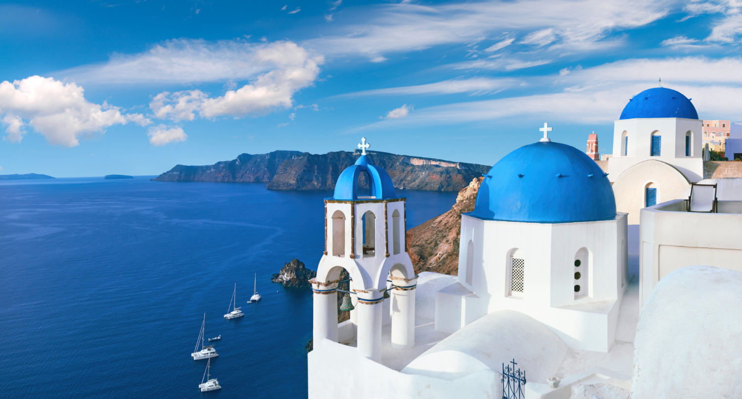
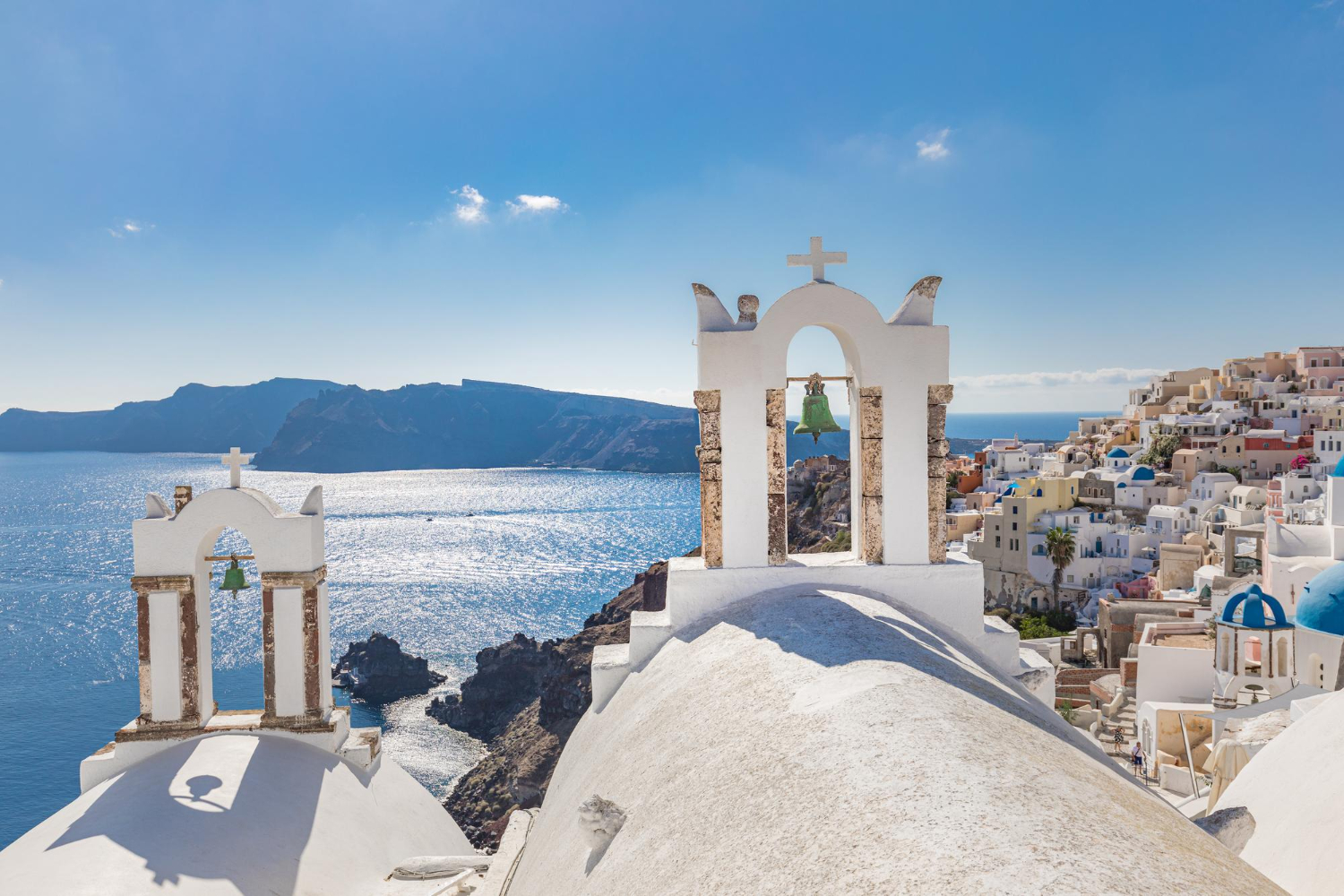
6: How People Actually Live on the Caldera Rim
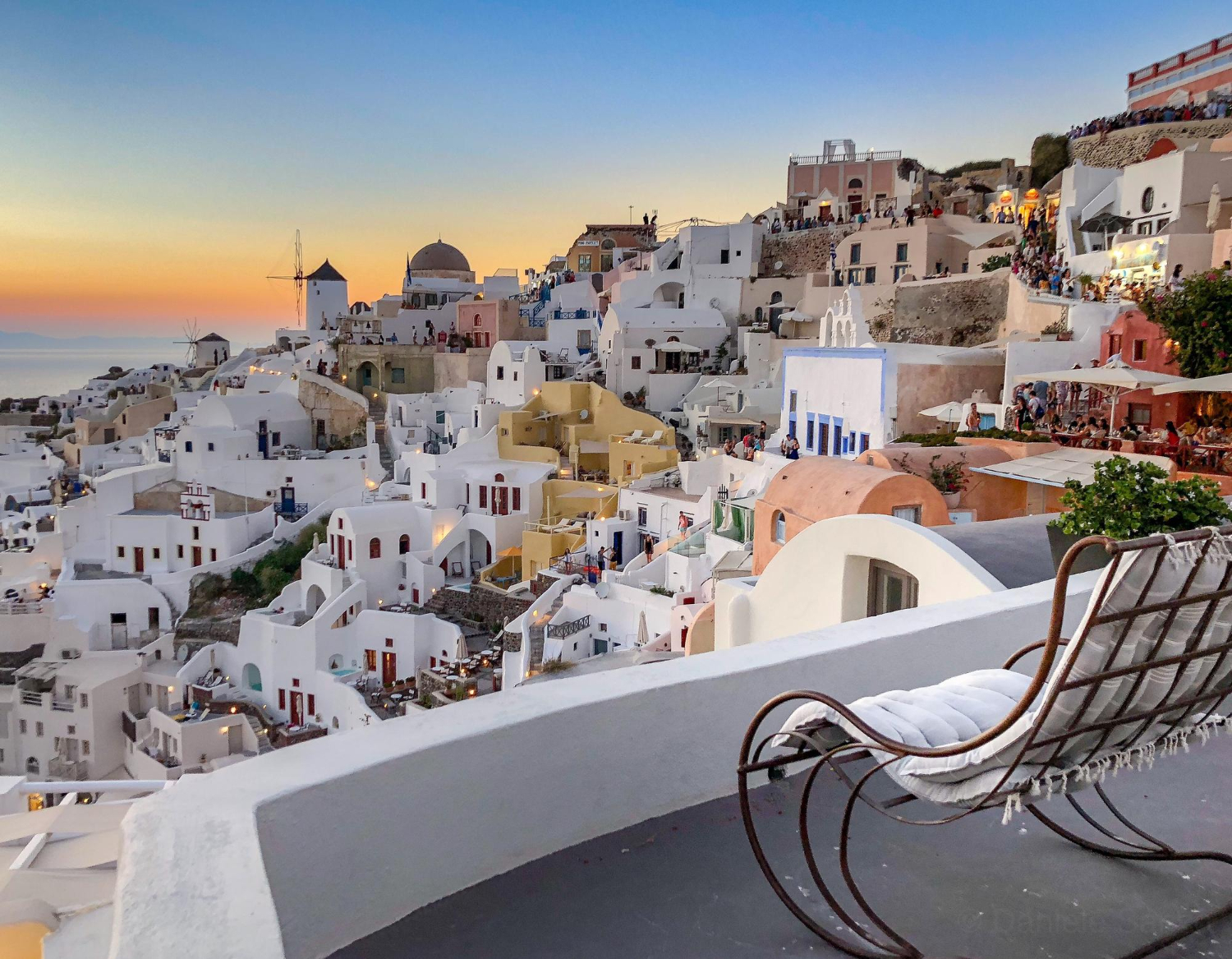
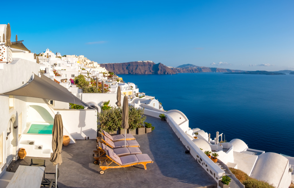
Modern Santorini’s iconic villages sit atop the caldera rim — specifically Oia, Fira (the capital), Firostefani, Imerovigli, and various other settlements. The cumulative villages sit at altitudes 200-300 meters above sea level on the cliff edge, providing dramatic views directly into the flooded caldera and toward the central Kameni islands. The white-and-blue architecture that defines Greek island aesthetic appearance is concentrated specifically in these caldera-edge villages.
The cumulative villages developed specifically because the caldera rim provided substantial defensive advantages and access to the sea. Pirates couldn’t easily reach cliff-top villages from the sea, and the substantial elevation provided early warning systems. The cumulative architecture evolved to handle volcanic ash deposits, earthquakes, and various other geological reality. Most buildings feature substantial structural reinforcement to handle ongoing seismic activity. The cumulative living arrangements represent specific adaptation to active volcano reality that residents have maintained across centuries.
7: The 1956 Earthquake
A substantial recent disaster affected Santorini in 1956 — major earthquake that caused substantial damage across the island. The cumulative earthquake combined with subsequent tsunamis that destroyed substantial coastal infrastructure. Various traditional villages were severely damaged. Hundreds of houses collapsed. Various residents permanently relocated to mainland Greece. The cumulative damage reduced Santorini’s population substantially during subsequent decades.
The cumulative recovery has been substantial across approximately 70 years since 1956. Tourism development has provided substantial economic activity that reversed previous population decline. Most current Santorini structures are post-1956 reconstruction — though built in traditional Greek island style that maintains the cumulative visual character. The cumulative volcanic and seismic risks remain. Santorini residents and authorities specifically maintain readiness for future major events that geological history suggests are essentially inevitable across longer time scales.
8: The 2024-2025 Volcanic Unrest
Santorini entered new phase of volcanic unrest starting July 2024 — substantial recent reminder that the cumulative volcano remains active. Specific seismic activity increased significantly starting mid-summer 2024. The most intense volcano-tectonic seismic sequence occurred in the broader Anydros islet area approximately 30 km northeast of Santorini since late January 2025. Substantial slow deformation was recorded inside the Santorini Caldera starting summer 2024.
A new seismic swarm was detected June 15, 2025. The earthquakes were mostly smaller than magnitude 3, clustered at depths 5-20 km along the SW-NE oriented Kameni tectonic line. The earthquake swarm was triggered by magma movement through fault system northeast of Santorini. The earthquakes ended approximately three months after they began, with magma remaining more than 8 km underground. The cumulative episode represented continuation of the seismic crisis that began summer 2024. Volcanic monitoring continues actively through Greek geological authorities.
9: The Specific Beaches
Santorini’s beaches reflect substantial geological diversity from the cumulative volcanic history. Red Beach features red volcanic rock and sand from specific iron-rich lava layers. Black Beach features black volcanic sand from cumulative lava deposits. White Beach features white volcanic ash and pumice. Various other beaches feature different colors based on which specific geological layer is exposed. The cumulative beach diversity is genuinely substantial within the small island area.
The darker-colored beaches have specifically warmer water because the dark lava substantially absorbs solar heat. The cumulative thermal effect makes swimming substantially more comfortable at darker beaches even during cooler weather. Various other beach characteristics — wave patterns, water clarity, current patterns, specific marine life — reflect specific geological conditions at each location. The cumulative geological diversity provides substantial variety despite the small island size.
10: How to Actually Visit Santorini
Practical guidance for travelers planning Santorini visits. Access is through Santorini International Airport (JTR) on the island, with substantial flight connections from Athens (45-minute flights) and various international cities (London, Paris, Frankfurt, various others). Multiple daily ferry services connect Santorini with Athens (Piraeus port, 4-8 hours depending on ferry type), various Cyclades islands (Mykonos, Paros, Naxos, Ios, etc.), and Crete (Heraklion port).
The cumulative best visiting periods: April through October provides typical Mediterranean weather. July and August feature substantial crowds and substantially elevated prices. May, June, September, and October provide better experience for travelers preferring less crowded conditions while maintaining good weather. November through March provides substantially quiet experience with limited tourist services. Booking accommodations 3-6 months in advance is essential for summer visits given substantial demand for caldera-view rooms. The cumulative trip costs are genuinely substantial — Santorini is among the more expensive Greek destinations.
11: The Tour Boat Reality
Most Santorini visitors take boat tours that visit Nea Kameni and Palea Kameni in the caldera center. The cumulative tours typically depart from old port at Skala (accessed from Fira via 588 steps, cable car, or by donkey — the donkey transportation has substantially attracted criticism from animal rights organizations), Athinios ferry port, Ammoudi at Oia, or Vlychada on the southern coast. Trip duration: typically 30 minutes from Athinios, 20 minutes from old port at Skala.
The cumulative tours typically include guided hike up Nea Kameni to active crater area (still venting steam and gases), swimming opportunity at Palea Kameni hot springs (geothermally warmed water), passage close to caldera walls for substantial geological observation, and various other elements. Various longer tour packages include additional stops at Therasia island, sunset cruise variations, and various other elements. The cumulative boat experience provides substantial perspective on the volcanic reality that mainstream cliff-top tourism doesn’t fully convey.
12: What Santorini Actually Represents
Santorini represents specific intersection of dramatic natural geology, substantial human history, and modern tourism economics that creates genuinely distinctive destination. The cumulative combination of active volcano, ancient civilization remnants, dramatic landscape, and modern tourism infrastructure produces experience that exists nowhere else in quite the same way. For travelers willing to look beyond the substantially photographed sunset views, the cumulative geological and historical depth substantially exceeds what mainstream Santorini tourism typically emphasizes. The cumulative volcanic activity will likely continue producing future eruptions across longer time scales — the question isn’t whether but when. Modern Santorini residents and authorities maintain substantial monitoring and readiness for such events while continuing to operate one of Europe’s most successful tourism destinations. The cumulative balance between dramatic natural reality and substantial economic activity represents specific successful adaptation to circumstances that mainstream destinations don’t typically face. Various visitors substantially underestimate the volcanic reality while photographing the cumulative results of that volcanic activity. The cumulative experience genuinely rewards visitors who specifically engage with the geological and historical depth rather than only the iconic visual elements.