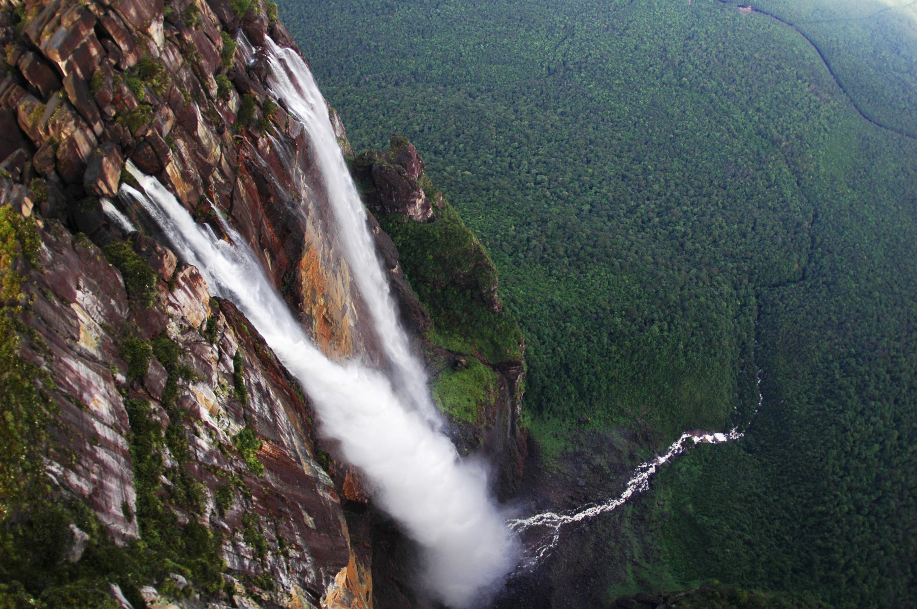
The water falls for nearly three-quarters of a mile. That is the fact that makes Angel Falls different from every other waterfall, because at that height the physics change: the column breaks up as it descends, air resistance disperses it, and by the time it reaches the bottom of the cliff a great deal of it is no longer water falling but a drifting cloud of droplets that soaks the forest for a considerable distance around.
It is in Canaima National Park in the Gran Sabana region of south-eastern Venezuela, it falls from a mountain called Auyan-tepui, and it is one of the genuinely remote major landmarks of the world. There is no road to it.
What it falls off, which is stranger than the fall
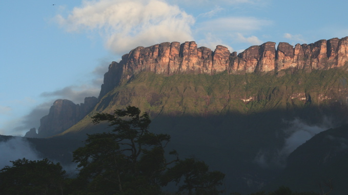
Auyan-tepui is a tepui, which is a form of mountain that barely exists anywhere else: a flat-topped block of ancient sandstone with sheer vertical walls, standing a thousand metres or more above the surrounding plain. There are around a hundred of them across the Guiana Highlands of Venezuela, Guyana and Brazil, and they are the eroded remnants of a single enormous sandstone plateau.
The rock itself is among the oldest exposed material on the planet, laid down in the Precambrian, and the shape is a consequence of how it weathers: the sandstone is hard and resists erosion laterally while fracturing vertically, so a tepui does not slope, it ends. The walls are frequently overhanging.
The summits have been isolated from the surrounding lowlands for an extremely long time and are effectively islands. They have their own plants, their own amphibians and in several cases species found on one tepui and nowhere else, which is why they are of serious interest to biologists. Several tepui summits have been climbed and surveyed only in the past few decades, and new species are still being described from them and why the comparison that is always made — Arthur Conan Doyle’s novel about a plateau where prehistoric life survived, which drew on accounts of these mountains — is less fanciful than it sounds.
Like our content? Follow us for more.
The American pilot who landed on top and could not take off
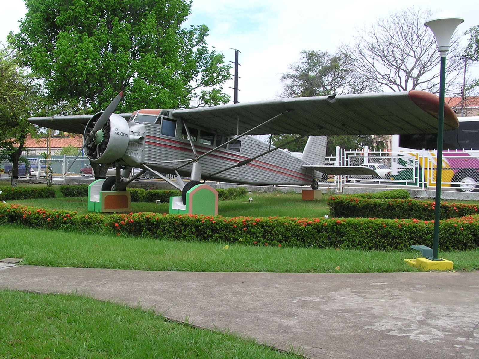
The name is a person’s. Jimmie Angel was an American aviator and bush pilot who first saw the falls from the air in 1933 while flying in search of a reported ore deposit, and who returned in 1937 and landed a light aircraft on the summit of Auyan-tepui.
The landing worked and the take-off did not. The ground was soft and boggy, the aircraft’s wheels sank, and Angel and the three people with him walked off the mountain over eleven days to get back down. The aeroplane stayed where it was for thirty-three years, visible on the summit, until it was recovered by helicopter in 1970 and put on display.
The falls had been reported earlier — a Venezuelan explorer reached them on the ground in 1912 and local Pemon people had of course always known the mountain — but it was Angel’s flights that brought them to international attention, and the English name has stuck despite an official push in 2009 to use the Pemon name, which translates roughly as the waterfall of the deepest place.
Who measured it, and how
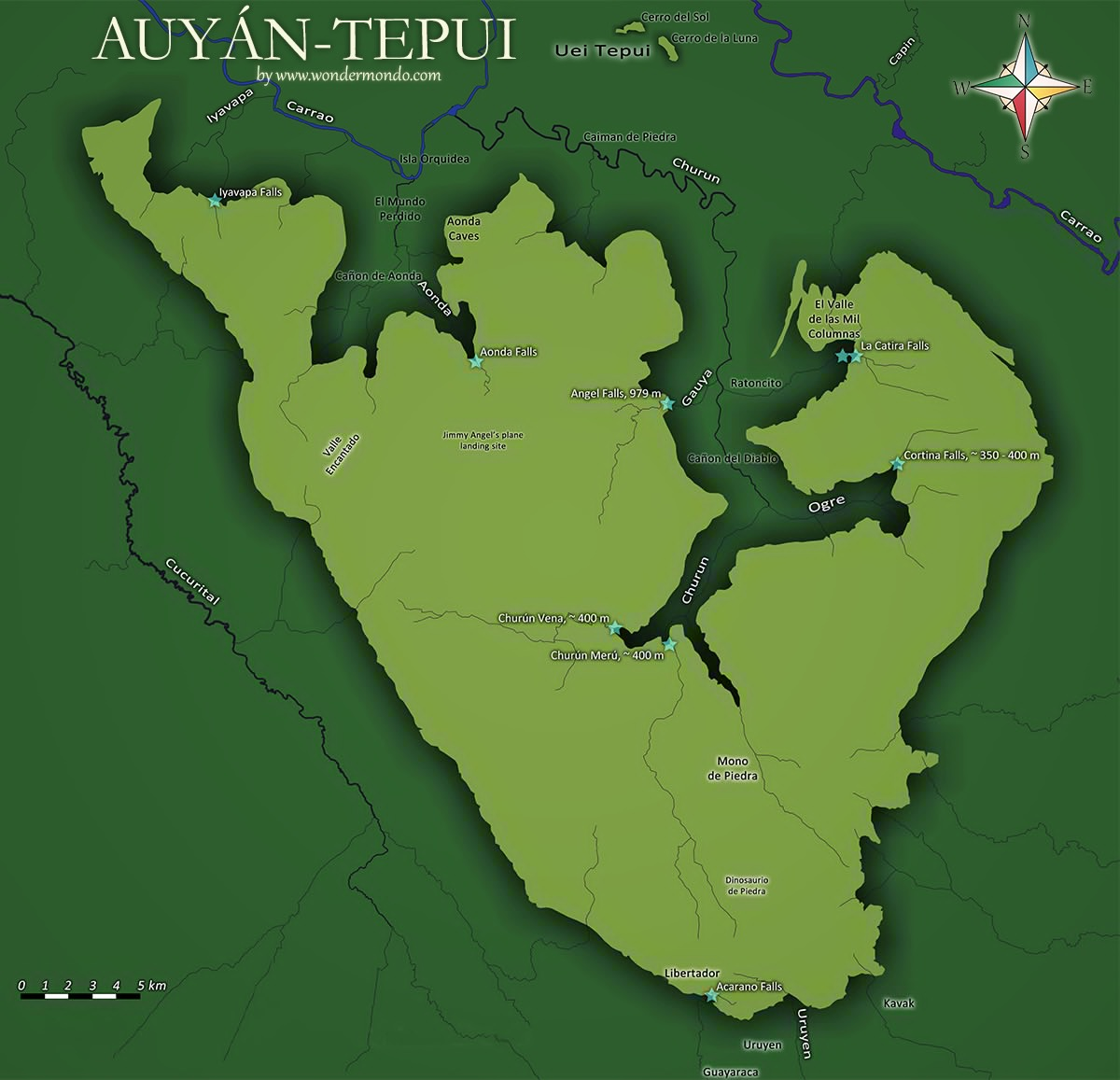
The height was established by an expedition in 1949 organised through the American Geographical Society and led by the journalist Ruth Robertson, which travelled up the rivers, reached the base, and surveyed the fall properly for the first time.
The figures that came out of it are the ones still used: a total height of 3,212 feet, with a single uninterrupted drop of 2,648 feet before the water strikes a ledge and continues as a series of cascades and rapids to the river below. That makes it the highest waterfall in the world by a wide margin — roughly three times the height of the next tier of famous falls — and the uninterrupted plunge is itself longer than almost any complete waterfall anywhere.
There are complications in the ranking, as there are with every superlative. Some lists treat multi-tiered falls differently, there are taller measurements claimed for submarine cataracts that nobody can see, and a glacial meltwater fall in Greenland has been proposed as taller on some definitions. By any ordinary definition of a waterfall on land that a person can stand and look at, this is the tallest.
The mist, and what it does to the place
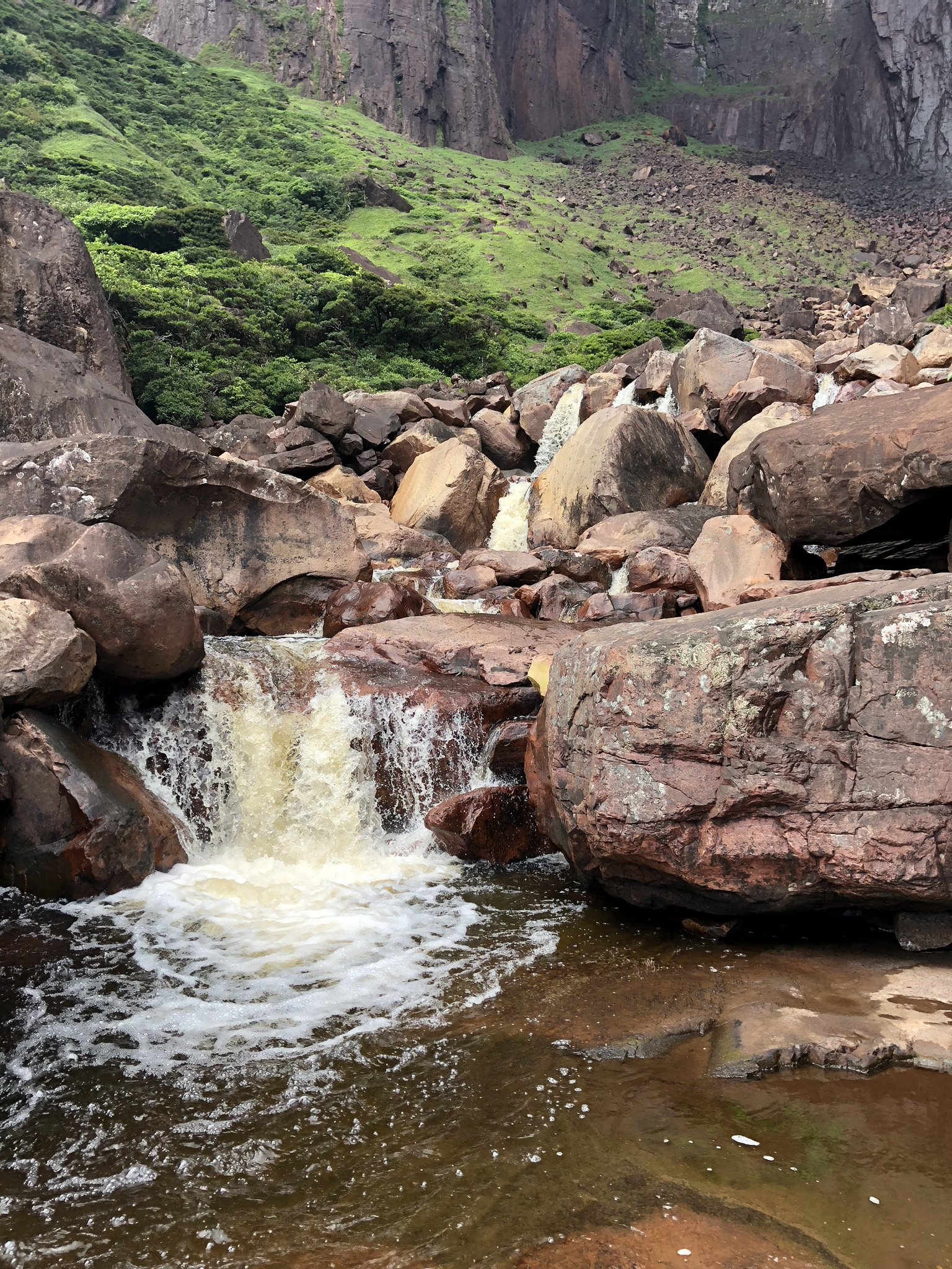
The behaviour of the water is the thing visitors describe. In the wet season, when the river on the summit is full, there is a substantial column for much of the descent and the base is a torrent. In the dry season the flow reduces to the point where the water atomises entirely partway down and arrives as a drifting curtain.
That permanent drenching has created its own microclimate at the foot of the cliff: a zone of continuously saturated air and soaked vegetation extending well beyond where the water lands, with mosses, ferns and bromeliads growing in conditions that have nothing to do with the regional rainfall. The sound is not the crash of a waterfall but something closer to continuous heavy rain.
It also means the falls look completely different depending on when you arrive, which matters more here than at most landmarks. A visitor in March may see a thread of vapour down a vast dark wall; a visitor in August sees the full thing.
The wet season is also when the cloud is worst, which is the trade-off nobody mentions. The months that fill the river are the months that hide the summit, and a party can spend three days at the base and never see the top of the cliff at all.
Getting there, which is the actual subject
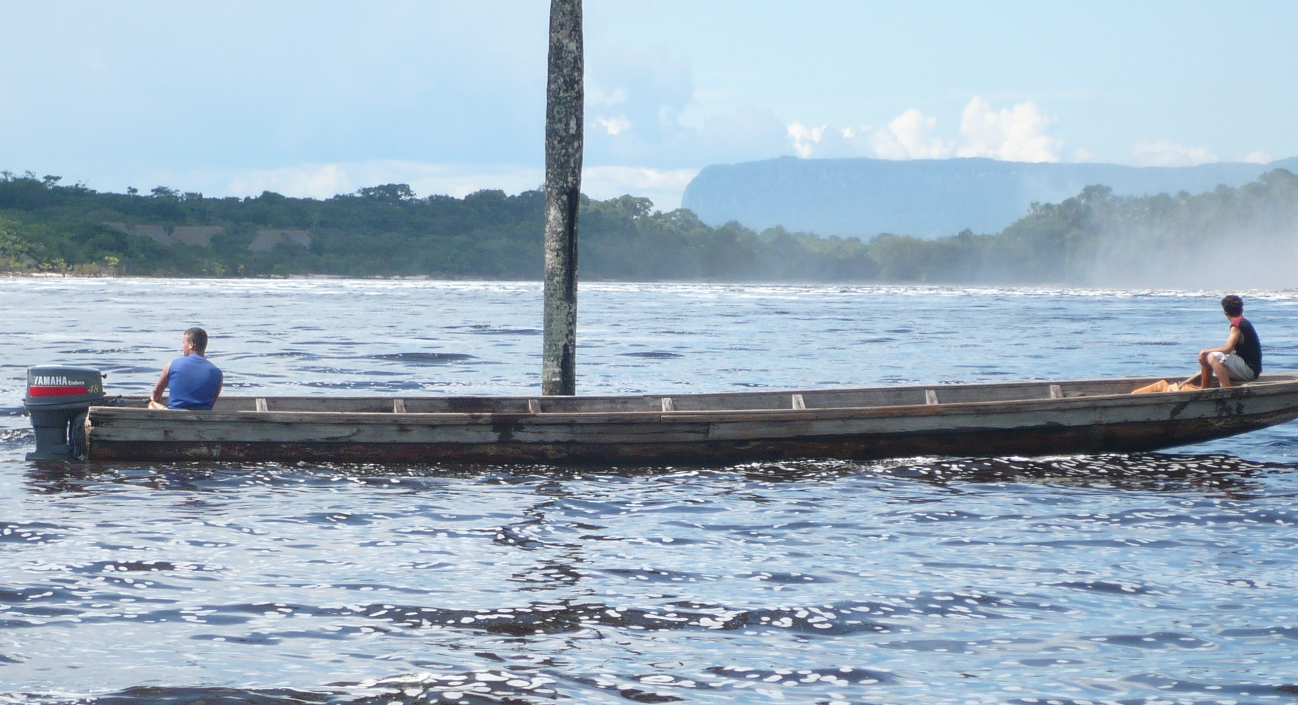
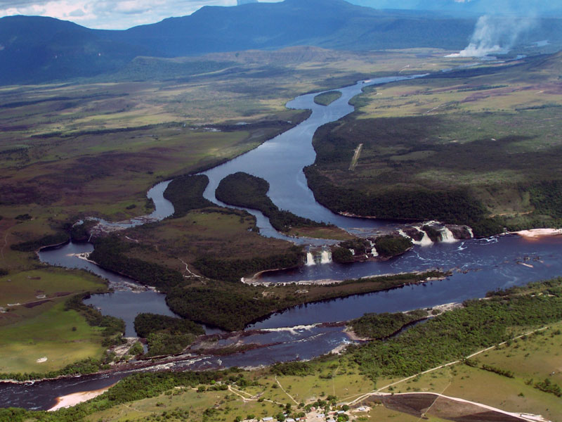
There is no road. The route is a flight into Canaima, a small settlement with an airstrip and a lagoon, reachable by light aircraft from Ciudad Bolivar or Puerto Ordaz, and from there a journey of several hours upriver by motorised dugout canoe along the Carrao and Churun rivers, followed by a walk of an hour or so through forest to a viewpoint at the base.
The river journey only works when the rivers are high enough, which confines ground access to the wet season, broadly June to December. Outside that window the canoes cannot get up the Churun and the falls can be seen only from the air, which is the trip a great many visitors take instead: a light aircraft flies along the cliff face, and in reasonable weather it is spectacular.
The practical realities are worth stating plainly. This is an organised expedition rather than a day out: trips run from Canaima with local operators, accommodation at the base is hammocks under a shelter, the weather closes the summit in cloud a great deal of the time, and the flights into Canaima are weather-dependent and are cancelled regularly. Nobody should be planning this as a side trip.
The part no article can tell you
Venezuela’s economic and political situation has affected tourism infrastructure, internal flights, fuel availability and the practicalities of independent travel very substantially over the past decade, and the position changes faster than any published guide can track. Travel advisories from various governments have been in place and have varied.
What that means for a reader is simple enough: the geography in this article is permanent and the logistics are not. Anybody seriously considering the trip needs current information from their own government’s travel advice, from operators actually running trips at the time, and ideally from somebody who has been recently, rather than from anything written down.
The falls themselves are entirely indifferent to all of it. They have been falling off that mountain for a very long time and the Pemon have been looking at them throughout, and the reason the place is hard to reach is the same reason it looks the way it does.
Why it is the tallest and nothing else is close
A waterfall this tall requires a specific and unusual combination: a hard, flat-topped massif with a vertical face of enormous height, a catchment on top of it large enough to maintain a river, and a lower landscape far enough below to give the drop. Almost everywhere else, one of those is missing. Mountains with the height have slopes rather than walls; cliffs with the verticality have no river on top.
The tepuis provide all three by accident of geology, and Auyan-tepui provides the most extreme version: a summit catchment of a reasonable size on a mountain whose side is a sheer drop of nearly a kilometre. That is why the record is held by a place almost nobody can get to rather than by a famous one, and why no obvious candidate is likely to displace it.
The broader point is the one that applies to most of the planet’s extremes. They are the product of particular combinations rather than of scale, which is why they turn up in places nobody would have nominated — on top of an ancient sandstone block in a corner of Venezuela with no road to it, found by accident by a pilot looking for something else entirely.
It is also worth sitting with the scale for a moment, because the number is hard to hold. Three thousand two hundred feet is more than twice the height of the tallest building in the United States. A drop of water leaving the summit takes roughly fourteen seconds to reach the bottom, which is long enough that it stops being a fall and becomes weather on the way down. That is the whole of what makes this place different from every other waterfall, and it is why the photographs never quite work: the eye has nothing in the frame to measure it against.
Like our content? Follow us for more.