
For those driving the 150-mile stretch of Interstate 10 between Phoenix and Tucson, the journey often feels like a routine desert transit. However, as the sun dips below the rugged horizon of the Picacho Mountains, the dynamic changes. While the highway is a critical artery for commerce, Arizona locals and long-haul truckers have a specific warning about the stretch near Mile Marker 190, a remote area within the Gila River Indian Community that becomes a high-risk zone after dark.
Whether it’s the lack of infrastructure or the unique geography of the Sonoran Desert, stopping here at night is a risk that many residents refuse to take. Here is why Mile Marker 190 has earned its reputation as the “Desert Void” of the I-10.
The “Second Darkest” Highway in the Nation
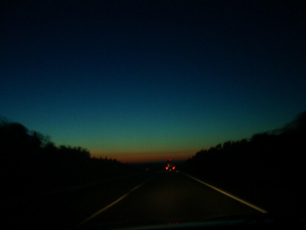
The primary reason locals avoid this area at night is the absolute lack of artificial lighting. According to national highway safety data, I-10 is ranked as the second darkest highway in the United States, and the stretch around Mile Marker 190 is a prime example of this “illumination desert.” Without the ambient light of the Phoenix or Tucson metros, visibility is limited strictly to the reach of your own headlights. For a driver pulling off the road or dealing with a mechanical failure, this near-total darkness makes you nearly invisible to high-speed traffic, significantly increasing the risk of a high-velocity rear-end collision on the shoulder.
The “Dust and Monsoon” Funnel
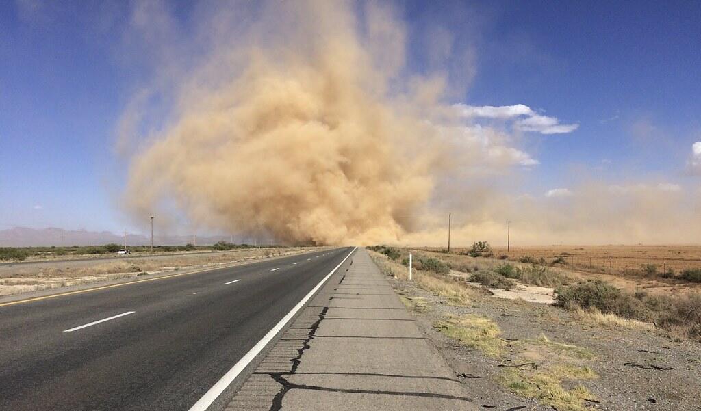
Geography plays a brutal role in the safety of Mile Marker 190. This specific segment of the I-10 sits within a natural low-lying basin that acts as a funnel for the region’s notorious “haboobs” (massive dust storms) and sudden monsoon downpours. Even on clear nights, the thermal shift in the desert can cause “micro-burst” winds that kick up fine silt, reducing visibility to zero in seconds. Locals warn that if you are stopped on the shoulder when a wall of dust hits, you are effectively trapped in a “blind box” where other drivers, frequently traveling at 75+ mph, cannot see your hazard lights until it is too late.
The “Dead Zone” for Emergency Response
While the I-10 is a major interstate, the response time for emergency services at Mile Marker 190 can be deceptively long. Because this stretch falls between major city jurisdictions and within tribal lands, the logistics of dispatching a tow truck or medical help are often more complex than in urban areas. Residents know that a breakdown here at 2:00 AM means waiting in a “service desert.” In the extreme desert cold of winter or the lingering heat of a summer night, being stranded for an hour or more without climate control can quickly transition from a vehicle issue to a medical emergency.
The Intoxication and Fatigue Corridor

Statistical data from the Arizona Department of Transportation (ADOT) confirms that the stretch between Phoenix and Tucson is one of the deadliest in the state, often involving high speeds and driver fatigue. Mile Marker 190 sits at a critical “fatigue point” for drivers making the long haul between California and Texas. Locals are wary of stopping at unlit pull-offs because they serve as “blind spots” for both law enforcement and exhausted drivers. There is a collective understanding that the safest way to navigate this “void” is to keep moving until you reach the well-lit, high-activity service centers in Eloy or Casa Grande.