Iceland’s F26 Sprengisandur route cuts 200km through the country’s interior between two glaciers — through black volcanic deserts with no fuel stations, no settlements, no cell coverage, and unbridged glacial river crossings. The route gained its name from medieval travelers who had to ride hard to get across alive. Modern Icelandic regulations now make it illegal to attempt without specific preparation. Here’s the actual history and the rules you need to know.
In medieval Iceland, travelers crossing between the country’s northern and southern regions faced a specific choice. The coastal route was longer but safer. The interior route — across the volcanic desert plateau between the Hofsjökull and Vatnajökull glaciers — was shorter but treacherous. The plateau, called Sprengisandur (“the blown sands”), had no shelter, no reliable water sources, no fuel for fires, no significant vegetation. Travelers had to carry everything they needed for the multi-day crossing and ride hard enough that they didn’t run out of supplies before reaching the other side.
The name “Sprengisandur” itself reflects this challenge. It comes from the Icelandic verb að sprengja, meaning to push or burst — the sands that you had to “burst across” to survive. Travelers who lingered too long, encountered unexpected weather, lost their way in fog, or had supplies fail typically died. The route’s reputation for fatalities became deeply embedded in Icelandic culture. The folk song “Á Sprengisandi,” still widely known in Iceland today, tells of ghostly riders eternally crossing the highland wastes — the spirits of travelers who never made it.
Today, the same route is designated as F-road F26 by the Icelandic Road and Coastal Administration. It’s still 200+ km of gravel road, still passes through the same volcanic desert, still has no fuel stations or services. But modern infrastructure — limited as it is — has made the crossing accessible to prepared travelers in proper vehicles. The Icelandic government has implemented specific regulations to prevent the crossings that historically killed travelers.
Here are the 5 specific things that make modern Sprengisandur crossings genuinely dangerous, the legal requirements that govern them, and what travelers should know before considering the route.
The geography that makes Sprengisandur dangerous
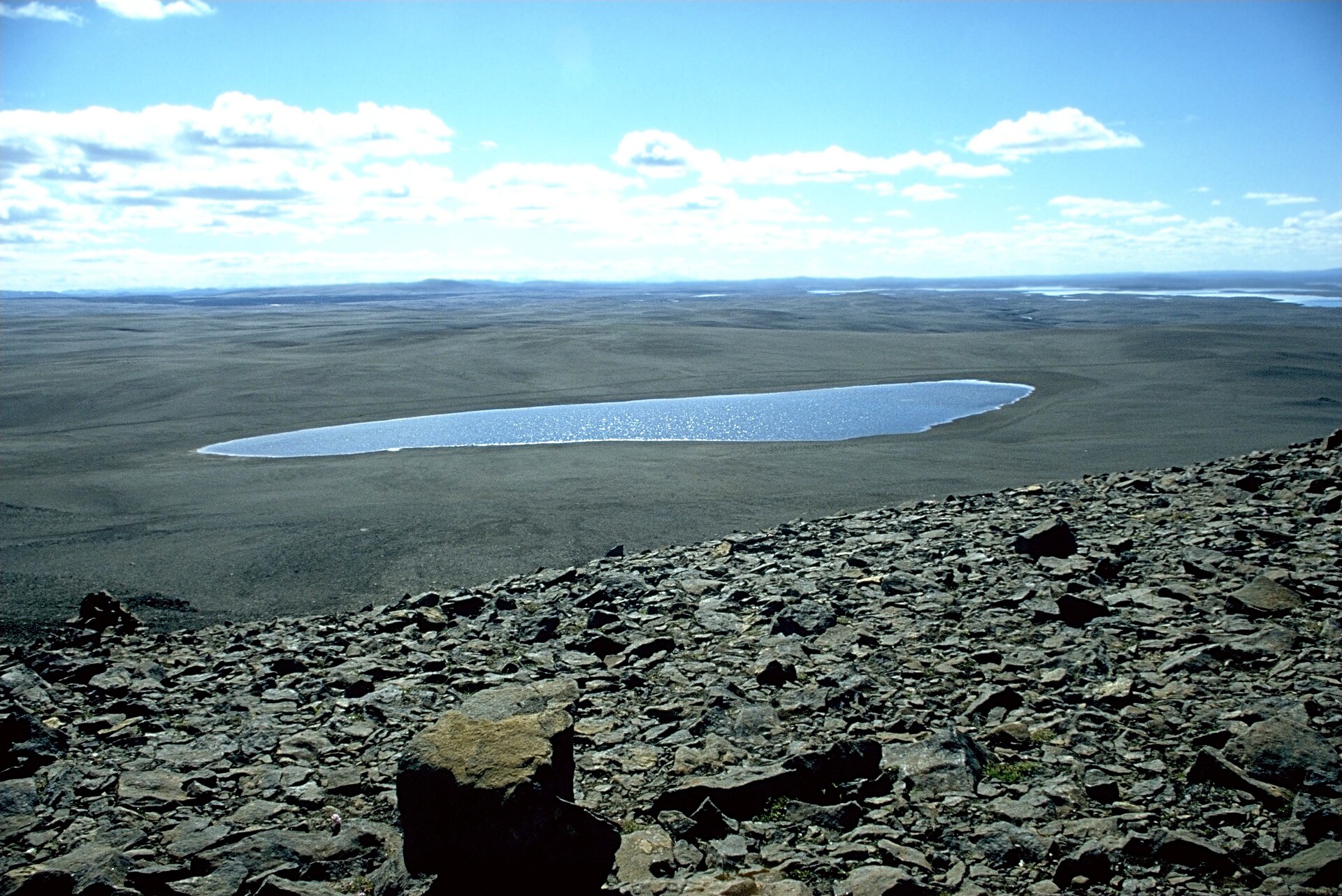
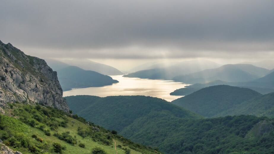
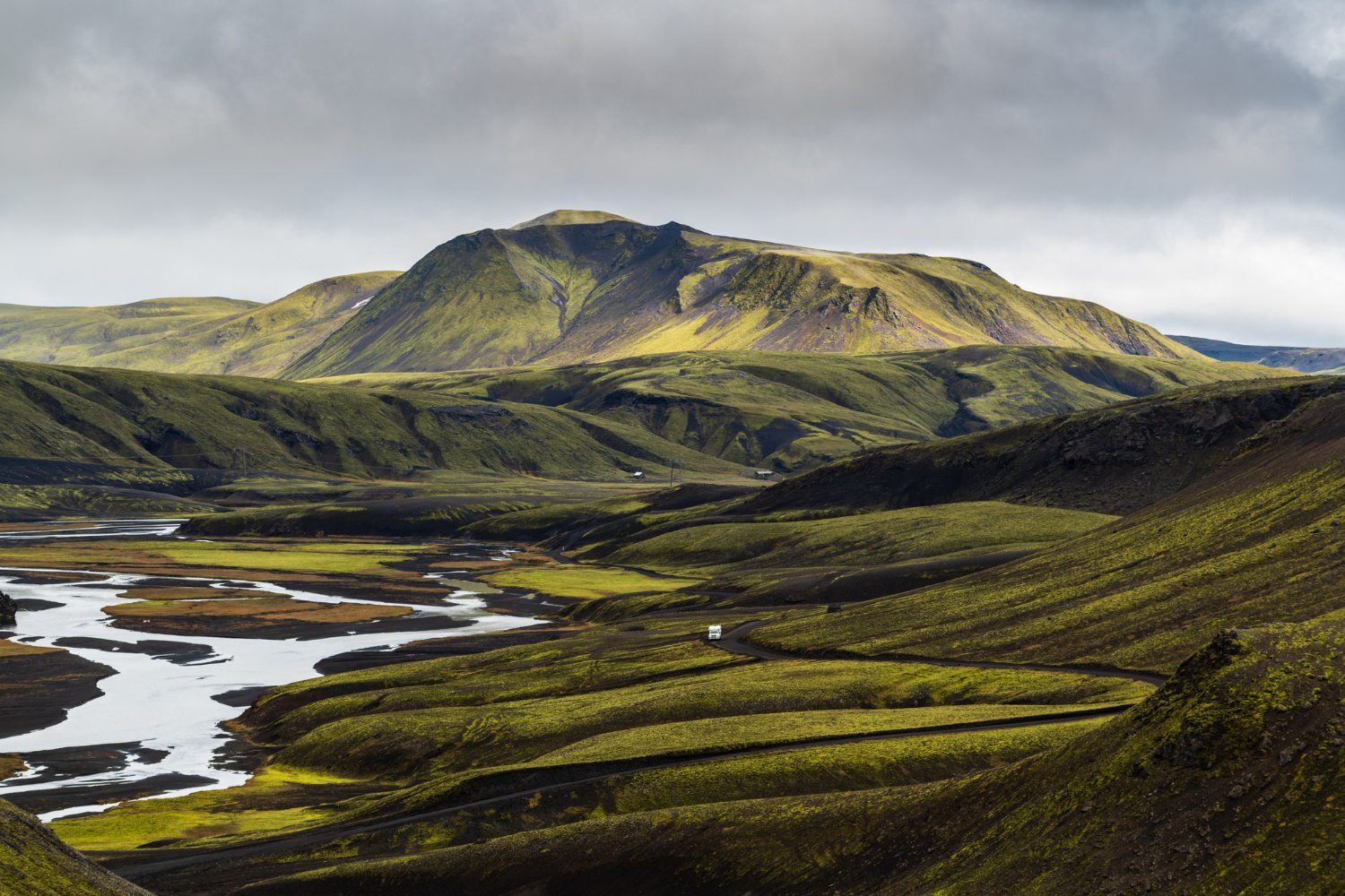
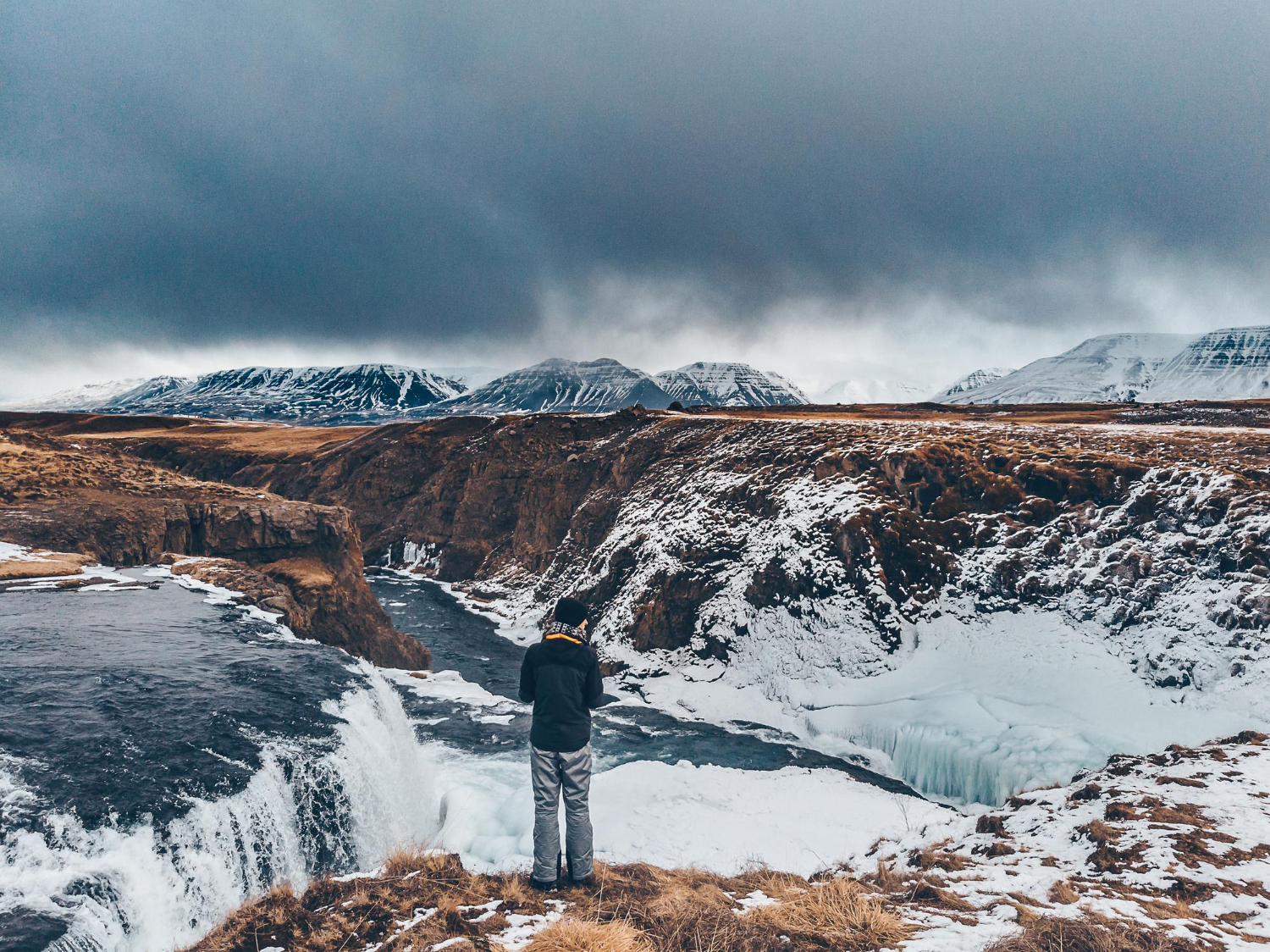
The Sprengisandur plateau sits in the heart of Iceland’s volcanic zone, between two of Iceland’s largest glaciers — Hofsjökull (the third-largest, at 925 square kilometers) to the west, and Vatnajökull (the largest, covering 8% of Iceland’s total area) to the east. The plateau itself averages 400-700 meters above sea level. The terrain is overwhelmingly volcanic — black sand, gravel, and basalt rocks left from thousands of years of volcanic activity in active Bárðarbunga-Veiðivötn volcanic system.
The road designated F26 runs approximately 200-250 kilometers between the southern end (near Hrauneyjar, where the last fuel station is located) and the northern end (near Goðafoss waterfall and the Akureyri region). The Icelandic Road and Coastal Administration’s official designation is F26 (“Sprengisandsleið”).
The defining geographic features that affect crossing difficulty:
No vegetation. The plateau is essentially treeless and supports only the most marginal plant life. There’s no firewood, no edible plants, no shelter from sun or wind.
Multiple glacial rivers. Several rivers cross the route, sourced from melting glaciers above. The most significant is the Hagakvíslar River near the Nýidalur hut. The rivers are unbridged — vehicles must drive through them. Water levels and current strength vary by hour, season, and weather conditions.
Extreme weather variability. Highland weather can change from clear sun to dangerous storm within an hour. Summer temperatures can reach 15-20°C (59-68°F) at midday and drop to near-freezing at night. Winter conditions are functionally arctic.
One settlement. A single mountain hut at Nýidalur (near the Hagakvíslar River crossing, roughly midway through the route) provides emergency shelter. Otherwise, the entire 200+ km has no permanent human presence.
No cell phone coverage. The vast majority of the route has no mobile signal. Modern emergency communication requires satellite devices.
No fuel. The gas stations at the southern end (Hrauneyjar) and northern end (Goðafoss/Akureyri area) are 240+ km apart with nothing in between.
The 5 specific reasons crossings remain dangerous (and now illegal without preparation)

1. Glacial river crossings that change by the hour
The Hagakvíslar River is the most significant hazard on F26. The river is fed by glacial melt, meaning water levels and current strength vary dramatically based on:
- Time of day (rising through afternoon as glaciers melt, dropping at night)
- Recent weather (rain dramatically increases flow)
- Recent temperatures (heat waves accelerate glacial melt)
- Season (peak summer produces highest flows)
Multiple deaths have occurred at this and similar crossings over the decades. The pattern: drivers underestimate the depth and current, attempt to drive through, and either get stranded mid-river or have their vehicle swept downstream.
The legal requirement: Icelandic regulations require 4×4 vehicles with appropriate ground clearance for F-road travel. Standard rental cars, 2WD vehicles, and small SUVs are explicitly prohibited from F-roads. Driving a non-compliant vehicle on F-roads voids rental insurance and produces fines.
The practical recommendation: Modified “super jeeps” with 38+ inch tires and snorkels can handle most river crossings safely. Standard 4×4 rentals (Toyota Land Cruiser, Toyota Hilux, similar) can handle most crossings in normal conditions but should not attempt during high water periods. Smaller 4x4s (Dacia Duster, Suzuki Jimny) can attempt in low-water conditions but are at risk during normal flow.
2. Vehicle requirements that visitors typically underestimate
The “4×4 required” rule sounds simple but requires more nuance than most visitors recognize:
A standard SUV is not enough. Many “4×4” rental vehicles in Iceland are actually all-wheel-drive crossovers (Toyota RAV4, Honda CR-V) with insufficient ground clearance for F-roads. These vehicles meet the technical “4×4” requirement but cannot safely traverse the terrain.
Ground clearance matters more than 4×4 capability. A vehicle with 200mm clearance handles F-roads much better than a vehicle with 4×4 capability but only 150mm clearance.
Tire size matters. Standard road tires struggle on F-road gravel, while proper all-terrain tires perform substantially better.
Recovery equipment matters. Vehicles getting stuck on F-roads cannot expect rapid recovery service. Self-recovery (winches, traction mats, etc.) substantially reduces risk.
The legal requirement: Iceland’s regulations require 4×4 vehicles for F-roads. Renting a 2WD vehicle and attempting an F-road both voids your insurance and exposes you to fines (over $3,000 in some cases).
3. Weather changes that arrive faster than you can respond
Iceland’s highland weather is notoriously unpredictable. The pattern that has killed travelers historically and continues to threaten modern travelers:
Sunny morning, dangerous afternoon. A pleasant 8 AM conditions can become whiteout fog, freezing rain, or snowstorm by 2 PM. Visibility can drop to 10 meters within minutes.
River swelling. Heavy rain dramatically increases river crossing difficulty within hours. A river that was easily passable in the morning may be impassable by afternoon.
Temperature drops. Summer temperatures can drop from 15°C to near-freezing within hours. Inadequately prepared travelers can experience hypothermia even in July.
Wind events. The plateau’s flat terrain provides no wind protection. Wind speeds of 30+ m/s (67+ mph) can occur with limited warning.
The legal requirement: Icelandic regulations don’t directly mandate weather monitoring, but indirect requirements (vehicle preparedness, emergency communication, route planning) effectively require travelers to be capable of responding to weather changes. The road.is website provides current road conditions; vedur.is provides weather forecasts. Both should be consulted before and during F26 attempts.
4. The communication gap that historically killed travelers
The Sprengisandur plateau has essentially no cell phone coverage outside the immediate area around the Nýidalur hut. The communication gap that historically killed medieval travelers — they could not signal for help if they encountered trouble — continues to threaten modern travelers without proper equipment.
The modern solutions:
- Satellite phones ($1-3/minute use, $500-1500 device cost) provide reliable communication
- InReach or SPOT satellite messengers ($150-400 device + subscription) provide tracking and emergency SOS functionality
- The SafeTravel.is system allows Icelandic authorities to register travel plans and provides automated check-in capabilities
The legal requirement: Icelandic regulations recommend (but don’t strictly require) satellite communication for highland travel. The SafeTravel.is registration is strongly recommended and has been credited with multiple successful rescues.
The practical implication: Travelers without satellite communication are reliant on encountering other travelers if they break down or experience medical emergencies. During shoulder season (early July, late August), other travelers may pass every few hours. During lower-traffic periods, vehicles may pass once per day or less.
5. The seasonal access window that most visitors don’t understand
F26 is not open year-round. The Icelandic Road and Coastal Administration determines opening and closing dates based on snow conditions, ground stability, and river conditions. The typical pattern:
Opening date: Late June to mid-July. Snow must clear, ground must thaw, and rivers must stabilize before the road opens. In cold years, opening can be delayed until late July.
Closing date: Early to mid-September. Weather changes typically force closure by mid-September. In some years, surprise September snowstorms have closed the route earlier.
Active season: 60-90 days per year. The actual window when F26 is reliably open and passable is short.
Off-season attempts are illegal and dangerous. Driving on closed F-roads is explicitly illegal under Icelandic regulations. Off-road driving (deviating from marked F-roads) carries fines exceeding $3,000.
The historical context that shaped these regulations
The modern regulations governing F26 didn’t develop in isolation — they emerged from centuries of accidents, deaths, and lessons learned. Specific elements of Iceland’s highland travel regulations reflect specific historical incidents:
The 1990s Touring Association reforms. After multiple highland fatalities involving inadequately prepared international tourists, the Icelandic Touring Association and government implemented stricter F-road designation and access controls.
The 2000s rental car regulations. As Iceland’s tourism industry grew rapidly, regulations targeting rental car compliance with F-road requirements were strengthened. Insurance industry refused to cover damage from F-road misuse, providing economic enforcement of legal requirements.
The 2010s search and rescue investments. Iceland’s volunteer search and rescue organization (ICE-SAR) expanded significantly, with substantial public investment in rescue capabilities. The increased rescue capability shifted some emphasis from prevention to response.
The 2020s tourism management. Post-pandemic tourism growth has produced renewed concern about inexperienced visitors attempting routes beyond their capabilities. Various initiatives (improved signage, mandatory rental briefings, expanded SafeTravel.is integration) have been implemented to manage the inexperience problem.
The historical pattern is consistent: incidents produce regulations, regulations reduce incidents, but the underlying geographic challenges remain unchanged. The Sprengisandur plateau is exactly as inhospitable today as it was in 1100. Modern infrastructure has reduced the practical danger by orders of magnitude, but the underlying terrain still kills travelers who underestimate it.
What appropriate preparation actually looks like

For travelers who want to attempt F26 in 2026, the appropriate preparation includes:
Vehicle. A genuine highland-capable 4×4 with substantial ground clearance, appropriate tires, and demonstrated river-crossing capability. Rental options include Toyota Land Cruiser, Toyota Hilux, Suzuki Jimny (smallest acceptable), and various super-jeep modifications. Cost: $200-500+ per day depending on vehicle class.
Insurance. Comprehensive insurance specifically including F-road coverage. Standard rental insurance typically excludes F-road damage entirely. Specific F-road coverage typically costs $30-80 per day.
Communication. Satellite phone or messenger device. SafeTravel.is registration before departure. Specific check-in points planned along the route.
Route planning. Specific timing for the crossing, with weather and road conditions verified within 24 hours of departure. Backup plans for shelter if weather changes.
Companionship. Multi-vehicle convoy strongly recommended for inexperienced highland drivers. Solo highland travel is legal but substantially riskier.
Physical supplies. Extra fuel (at least 20 liters), extra food and water (3+ days supply), warm clothing and emergency shelter, first aid supplies, recovery equipment.
Knowledge. Understanding of river crossing technique, ability to read weather changes, knowledge of how to assess current conditions. The Icelandic Road and Coastal Administration publishes guidance materials.
Realistic timing. Plan a full day for the crossing, with no major activities scheduled for the day after. Begin early in the morning to maximize daylight for any unexpected delays.
Costs. A properly prepared single-day crossing of F26 typically costs $400-800 in vehicle, fuel, and insurance costs, beyond the costs of getting to and from the highland entry points.
What to do if F26 isn’t right for you
Many international travelers want to experience Iceland’s highlands without committing to the Sprengisandur crossing. Several alternatives exist:
F35 (Kjölur). The other major north-south highland route. Less challenging than F26, with no significant river crossings. Standard 4×4 vehicles are sufficient. Often opens earlier and closes later than F26. Provides similar highland experience without the river crossing complexity.
F208 (Landmannalaugar). Popular destination for highland day trips. Northern section is straightforward; southern section has ~10 small river crossings. The Landmannalaugar area itself includes hot springs, dramatic colored mountains, and substantial hiking opportunities.
F249 (Þórsmörk). Highland valley between three glaciers. Multiple river crossings make this challenging, but the destination is widely considered worth it. Popular for organized super-jeep tours that handle the river crossings safely.
F910 (Askja). Volcanic crater route. Substantially more challenging than F26 in some sections, but offers unique geological experiences.
Organized tours. Iceland has numerous tour companies offering super-jeep, snowmobile, and other guided highland experiences. Costs are higher than self-driving (typically $200-500+ per person per day) but eliminate vehicle and route planning concerns.
Aerial views. Helicopter and small plane tours of the highlands provide dramatic views without driving requirements. Costs $400-800+ per person but require no specialized preparation.
What this all reveals about Iceland’s relationship with its highlands
The Sprengisandur regulations reflect Iceland’s specific cultural relationship with its dangerous interior. Unlike other countries with extreme terrain (the American National Parks system, Switzerland’s Alpine regions, Australia’s Outback), Iceland has chosen relatively permissive access to its highlands combined with stringent vehicle and preparation requirements.
The philosophy: Icelanders themselves have used these routes for over a thousand years. The country values the wilderness experience that highland travel provides. But the country also recognizes that inadequate preparation kills people, and that international tourists frequently arrive with inadequate understanding of what they’re undertaking.
The compromise — F-road designation, mandatory 4×4 vehicles, insurance industry alignment with regulations, search and rescue infrastructure investment, SafeTravel.is registration, weather monitoring services — represents an attempt to maintain access while reducing the casualty rate that historically characterized highland travel.
For travelers in 2026, the practical implications are clear:
The Sprengisandur experience is real and worth having for properly prepared travelers. The landscape, the historical resonance, the sense of genuine wilderness — all of these remain available to people who undertake the crossing appropriately.
The Sprengisandur experience is not safe for unprepared travelers. Despite modern infrastructure, the route can kill people who underestimate it. The historical pattern of fatalities continues, just at lower rates than in centuries past.
The preparation requirements are real, not bureaucratic obstacles. Every requirement (vehicle specifications, communication equipment, weather monitoring, route registration) addresses specific historical patterns of fatalities. Following the requirements substantially reduces but doesn’t eliminate risk.
Alternative experiences exist. Travelers who want highland experience without F26 commitment have multiple options that provide substantial wilderness exposure with significantly lower risk profiles.
The medieval folk song about ghostly riders eternally crossing Sprengisandur isn’t just folklore — it’s a cultural memory of the centuries when this route killed travelers regularly. Modern Iceland has built infrastructure and regulations specifically to prevent the next generation of travelers from joining the ghosts. For visitors planning Iceland trips in 2026 and beyond, the route remains accessible — but only on terms that respect what the route has historically demanded of travelers brave or foolish enough to cross it.