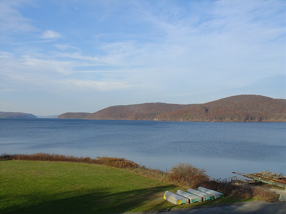
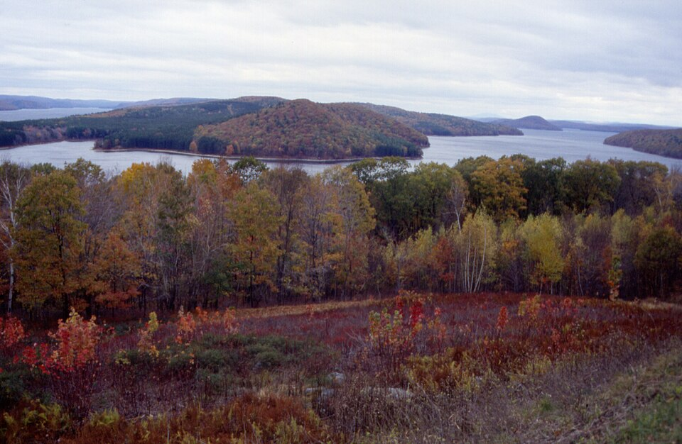
Turn on a tap in Boston and the water that comes out has traveled sixty-five miles from a reservoir in the hills of central Massachusetts — a vast, island-dotted inland sea so clean and so protected that it looks like wilderness Canada transplanted into New England. It is one of the largest unfiltered water supplies in the country, a refuge where bald eagles returned to Massachusetts, and by common consent one of the loveliest places in the state.
It is also a grave of towns. Beneath and around the Quabbin Reservoir’s waters lies the Swift River Valley, where four incorporated Massachusetts towns — with their commons, churches, mills, schoolhouses, and cemeteries — were dissolved, emptied, and erased in the 1930s so that metropolitan Boston could drink. The story of how a state unmade four of its own towns, and what the displaced took with them, has become one of New England’s defining legends precisely because none of it is legend. There are people alive today who were children in towns that no longer exist, and hikers this weekend will walk down Dana’s town common, still edged with cellar holes and stone walls, to look at the water that took everything else.
A Thirsty City and a Valley in the Way
The arithmetic that doomed the valley was set by the 1920s: Boston and its suburbs were growing past what their existing reservoirs could supply, and engineers surveying for the next great source kept arriving at the same answer. The Swift River Valley was a water engineer’s dream — a deep, branching valley of clean hills, sparse population, and convenient geology, needing only two large earthen dams to become a reservoir of staggering capacity. The valley’s four towns were small, agricultural, and politically weightless: Dana, Enfield, Greenwich (the oldest, founded in the 1750s), and Prescott, home together to about 2,500 people whose families had in many cases worked the same land since before the Revolution.
The state’s decision arrived with the blunt certainty of the era’s great public works. Legislation in 1927 set the project in motion; the Swift River Act gave the valley its sentence, and residents spent the following decade in the strange position of living in towns with an announced expiration date — watching surveyors mark their farms, negotiating buyouts widely resented as inadequate, attending final town meetings, and burying their dead knowing the graves would not stay. Some families moved their houses whole, jacked onto trucks and hauled over the hills to neighboring towns, where dozens of Swift River Valley buildings still stand today under other addresses. Everything that couldn’t move — mills, barns, the brush and woodland itself — was leveled and burned by work crews, because a drinking-water reservoir required a scoured floor.
Like our content? Follow us for more.
The Firemen’s Ball at the End of the World
The valley’s ending had an actual final night, and it has entered New England lore. On April 27, 1938, the four towns’ official existence expired at midnight — and Enfield marked it with a farewell ball in the town hall. Hundreds packed the building and hundreds more stood outside; the orchestra played through the evening, and as midnight approached the hall went quiet for the countdown. At twelve, the band played “Auld Lang Syne,” and accounts from that night describe what the phrase “not a dry eye” was invented for — dancers standing in a town that, with the last note, had legally ceased to be. The next morning the remaining wind-down continued as if the music had never happened; within a year, the dams were sealed, and the Swift River began to pool.
Seven Years to Fill, and the Dead Moved Too
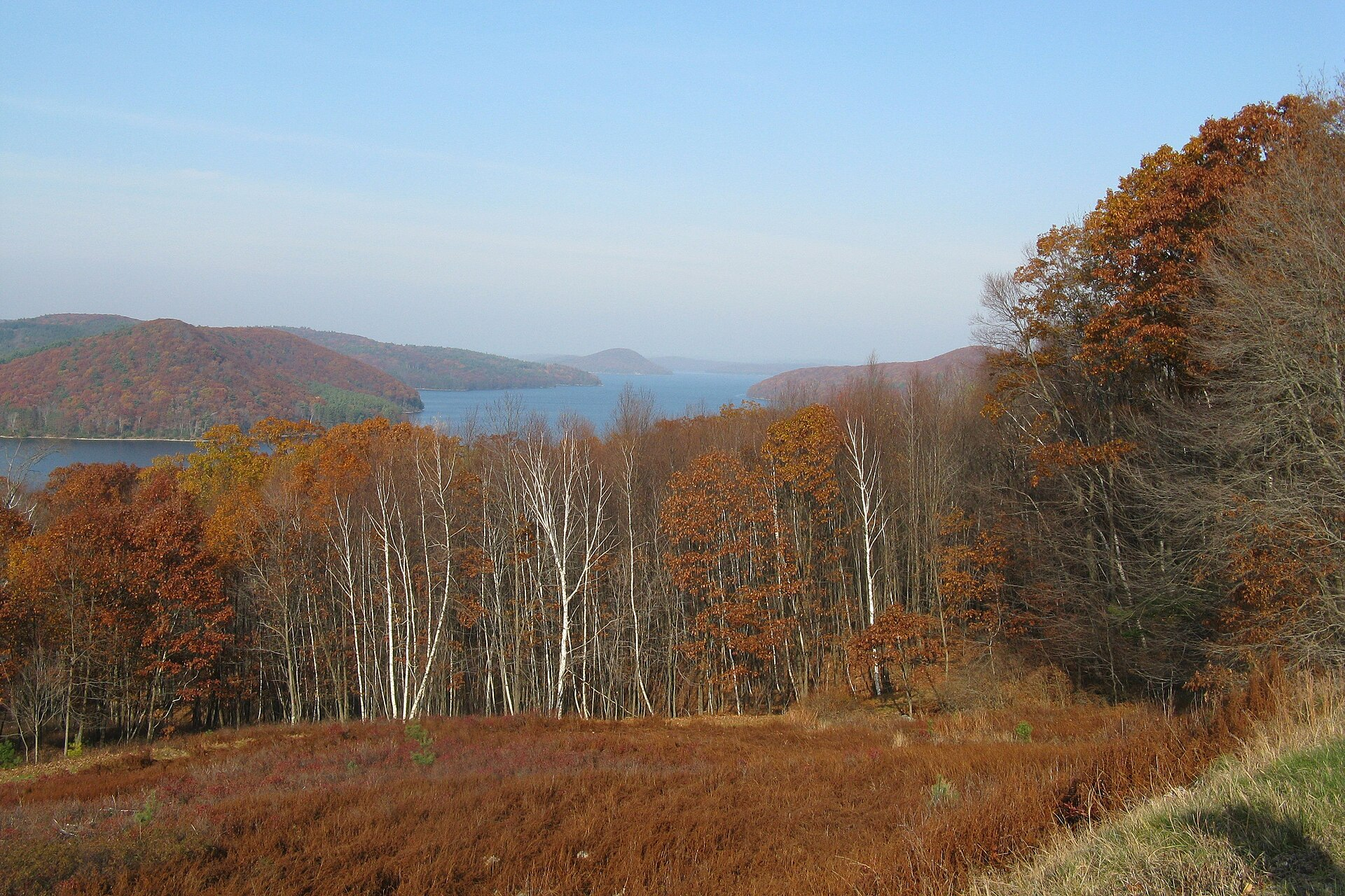
The filling took seven years. The waters rose through razed farmyards and over roadbeds from 1939 until 1946, when the reservoir finally reached capacity: 412 billion gallons, eighteen miles long, with thirty-nine square miles of water where the valley floor had been. The hilltops of the drowned landscape became the Quabbin’s islands — sixty of them — and Prescott’s high ridge survived as a peninsula, closed to the public ever since, arguably the most untouched square miles in southern New England.
And the dead moved too. In one of the project’s most sobering undertakings, some 7,500 graves were disinterred from the valley’s cemeteries and reburied — most in Quabbin Park Cemetery in Ware, built by the state for the purpose — with families given the melancholy work of choosing plots for ancestors who had already been buried once. The cemetery today functions as the four towns’ collective memorial, its sections organized by the communities that no longer exist.
One detail from the transition haunts visitors most reliably: the postal service’s role. In the towns’ final months, residents mailed letters simply to have them postmarked — Enfield, Mass.; Dana, Mass. — collecting the cancellations as proof their homes had existed, and on the last day the postmasters stamped final outgoing mail before the offices closed forever. Those envelopes are prized artifacts now, traded among collectors and displayed at the historical society: ordinary letters made extraordinary by a postmark that can never be struck again.
What the Water Gave Back
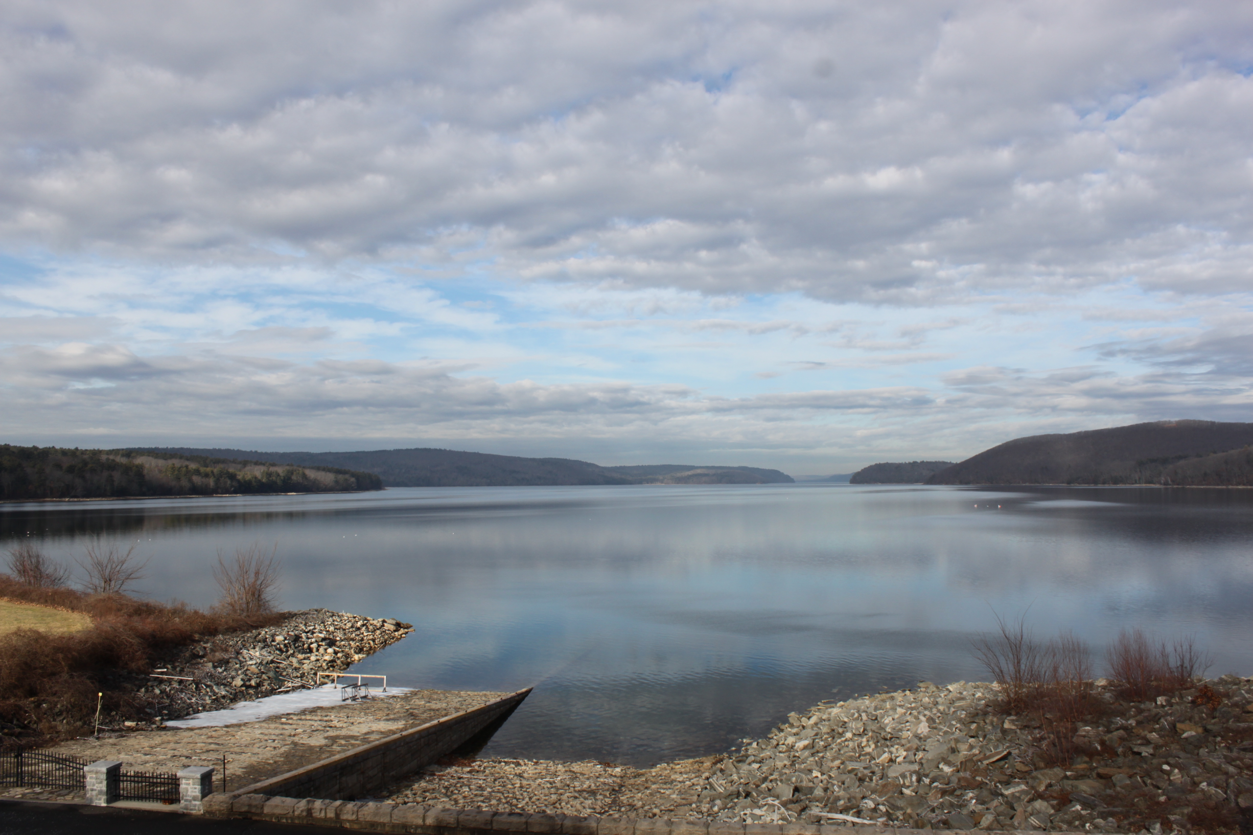
Here is where the story turns, because the Quabbin’s second act has been extraordinary. The watershed’s protection — no swimming, no development, restricted access, tens of thousands of acres of surrounding forest kept wild for water purity — accidentally created the largest conservation area in southern New England. Wildlife filled it: the state’s first returning bald eagles fledged at the Quabbin in the 1980s after a reintroduction program, and the reservoir now hosts eagles, loons, moose, bobcats, and a fishing culture (boat access is permitted under careful rules) that regards the water as hallowed. The water itself remains so clean that, like Hetch Hetchy’s, it holds a rare federal waiver from filtration — the drowned valley’s hills doing forever the job they were flooded for.
Visitors get a landscape unlike anything else in the region: from the observation tower and dam walkways at Quabbin Park in Belchertown, the view runs north over island after island to a horizon with no buildings in it at all — in Massachusetts, the third-densest state in the nation. The silence up there is the project’s strangest product. It cost four towns, and it sounds like it.
Walking Into a Town That Isn’t There
The Quabbin’s most affecting experience requires a short, flat walk. From Gate 40 on the reservoir’s east side, an old paved road — the actual road to Dana — leads about three-quarters of a mile through the woods to Dana Common, the town center of a municipality dissolved in 1938. The common itself was never flooded; it sits above the waterline, which means it survives as a perfect ghost: the green still open, the roads still meeting at their old angles, cellar holes and granite steps marking the town hall, the church, the school, the houses, each with a small marker. The site is on the National Register of Historic Places, and former residents and their descendants hold reunions there — picnics on the common of a town that exists now as clearings, foundations, and people who remember.
Two ground rules keep the pilgrimage respectful: the cellar holes are archaeological features, not climbing structures — take photographs, leave the granite where the towns left it — and the reservoir itself stays untouched, no wading or swimming anywhere, a restriction rangers enforce without humor because two and a half million people drink the reason why. The former residents’ descendants still walk these roads; the courtesy owed a graveyard applies to a drowned town’s common.
Bring the usual: water, bug spray in summer, and more time than the mileage suggests, because the markers slow everyone down. The wider reservation offers fifty-plus numbered gates for hiking and fishing access, the excellent Swift River Valley Historical Society museum in nearby New Salem — filled with the towns’ salvaged signs, photographs, and furniture — and, for the full pilgrimage, Quabbin Park Cemetery in Ware. October is the connoisseur’s month, when the drowned valley’s islands turn red and gold and the whole enormous quiet gets its color; winter brings eagle-watching along the open water, and spring fills the old roads with returning birdsong.
The Quabbin asks its visitors to hold two truths that don’t reconcile: the reservoir is a masterpiece — clean water for millions, wilderness reborn, eagles over the islands — and it is also four towns’ worth of front porches at the bottom of a lake. New England has never decided which truth outweighs the other, which is why the place pulls people back. Stand on Dana Common some quiet morning and you can hear the answer the valley settled on: both, forever, in the same still water.
Like our content? Follow us for more.