Rainfall records are usually a matter of a few inches separating one place from another. The figures from the southern edge of the Meghalaya plateau in northeast India are not like that. They are so far beyond the rest of the inhabited world that the comparison stops being useful: this is a landscape where the annual total is measured in feet, where a single month has delivered more rain than London gets in several years, and where the practical problems of living are not the ones that rain usually causes.
Two settlements on that escarpment trade the title of wettest place on earth between them, depending on which average and which period is used. Both are in the East Khasi Hills. Both are ordinary places where people farm, go to school and run shops, and the thing worth travelling to see there is not the rain itself but what several centuries of it have taught people to build.
The numbers
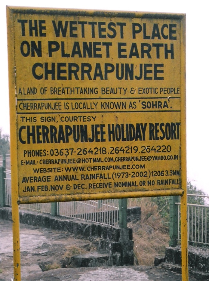
The averages first. One of the two villages has a mean annual rainfall of a little under twelve thousand millimetres, which is around thirty-nine feet. The other is close behind and has at times held the higher average. For comparison, a wet city in the Pacific Northwest of the United States might get a tenth of that.
The records are more extreme still. The famous figure comes from the nineteenth century: in the twelve months to the middle of 1861, one of these stations recorded on the order of a thousand inches of rain, which is about twenty-six metres. The monthly record from the same period is around nine thousand millimetres, in July alone. Those numbers have stood for more than a century and a half and are still, by a wide margin, the highest reliably recorded rainfall totals for any inhabited place. The rain is also overwhelmingly concentrated: the monsoon months deliver almost all of it, and the dry season is genuinely dry.
Like our content? Follow us for more.
Why the water comes down there
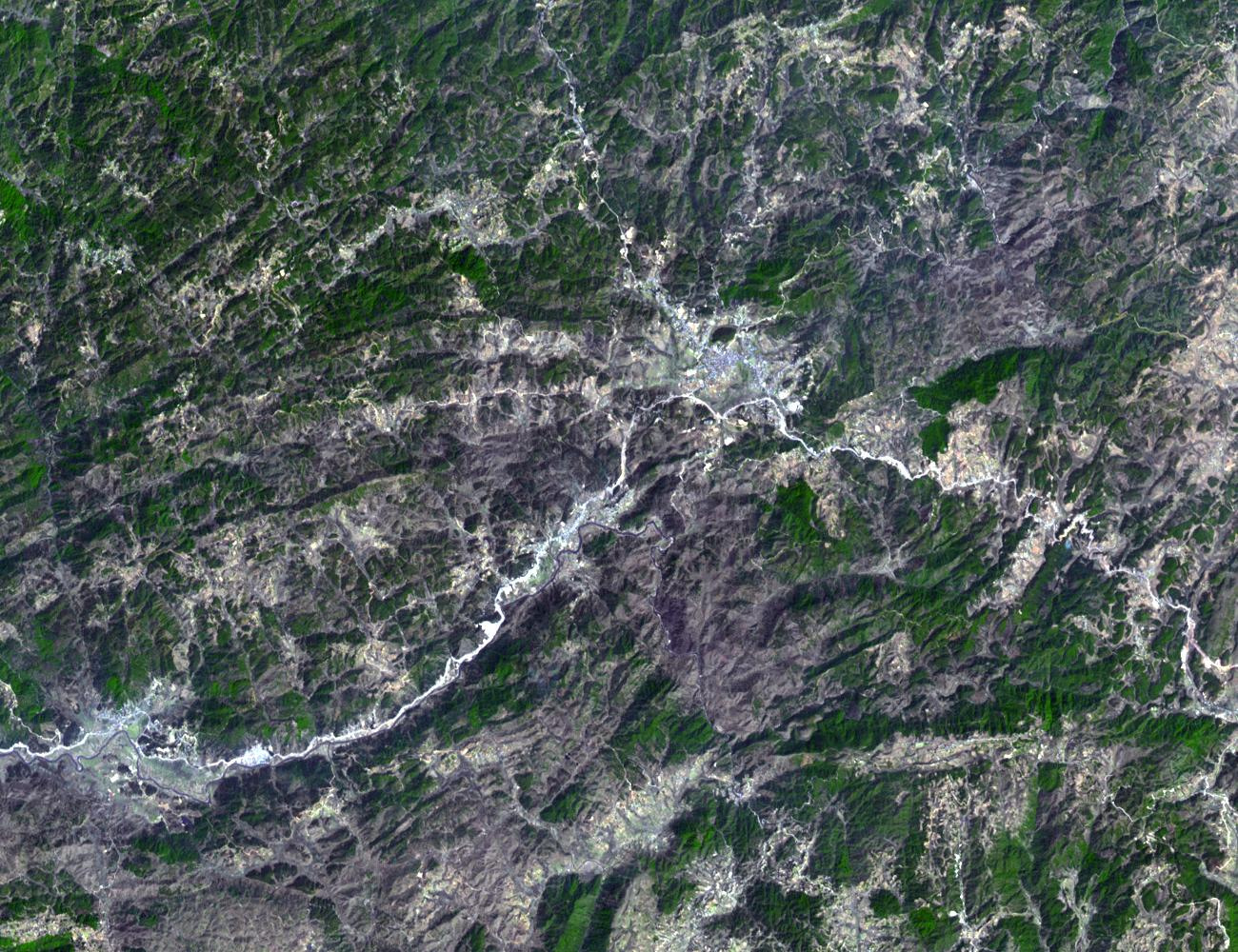
The mechanism is topographic and it is unusually clean. Monsoon air moves north from the Bay of Bengal across the flat, low, wet plains of Bangladesh, picking up moisture the whole way with nothing to lift it. Then it meets the southern wall of the Meghalaya plateau, which rises abruptly out of the plain.
The air has nowhere to go but up. Rising air cools, cooling air cannot hold its moisture, and the moisture falls out on the escarpment. The particular geometry of the hills matters: the slope faces directly into the monsoon flow, and in places the valleys funnel the air so that the lifting is concentrated into a narrow zone. That is why the record stations are where they are and why a place thirty miles away on the plateau top gets a fraction of the same rain. It is the most emphatic demonstration of orographic rainfall anywhere on the planet.
It also explains why the record has never seriously been challenged. Other places have the moisture, and other places have the mountains, but very few have the particular arrangement of a long overwater fetch, an enormous flat sodden approach, and then a wall. Remove any one of the three and the figures drop by an order of magnitude. The escarpment is not simply wet; it is a machine for converting a monsoon into rainfall at one specific line on the map.
The paradox of a water shortage
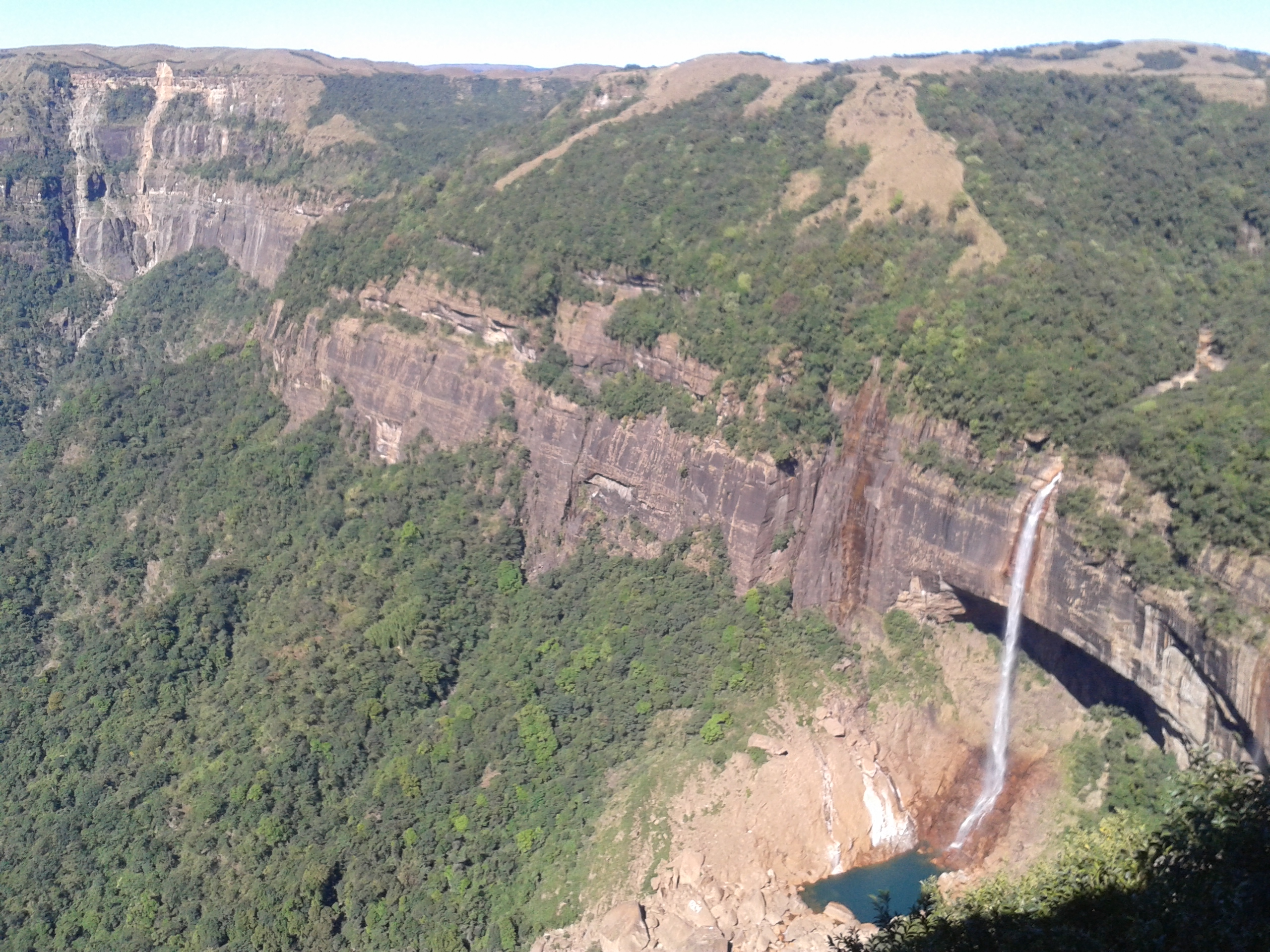
The thing that confounds visitors is that these villages have historically had trouble with water supply. Receiving forty feet of rain a year does not mean having water, for two reasons.
The first is timing. Almost all of it arrives in a few months and then stops, and storing a monsoon’s worth of water is an engineering problem that a hill village with thin soil cannot easily solve. The second is the ground. The plateau edge is steep and in many places the soil cover is shallow over rock, so water that falls runs off immediately and goes down into the plains rather than soaking in. Deforestation on parts of the plateau made this worse through the twentieth century by removing the canopy and root structure that slowed the runoff. The result is a place that is famous for rain and has spent decades working on rainwater harvesting and piped supply, which reads as absurd and is in fact a perfectly ordinary consequence of too much water arriving too fast on a slope.
The bridges
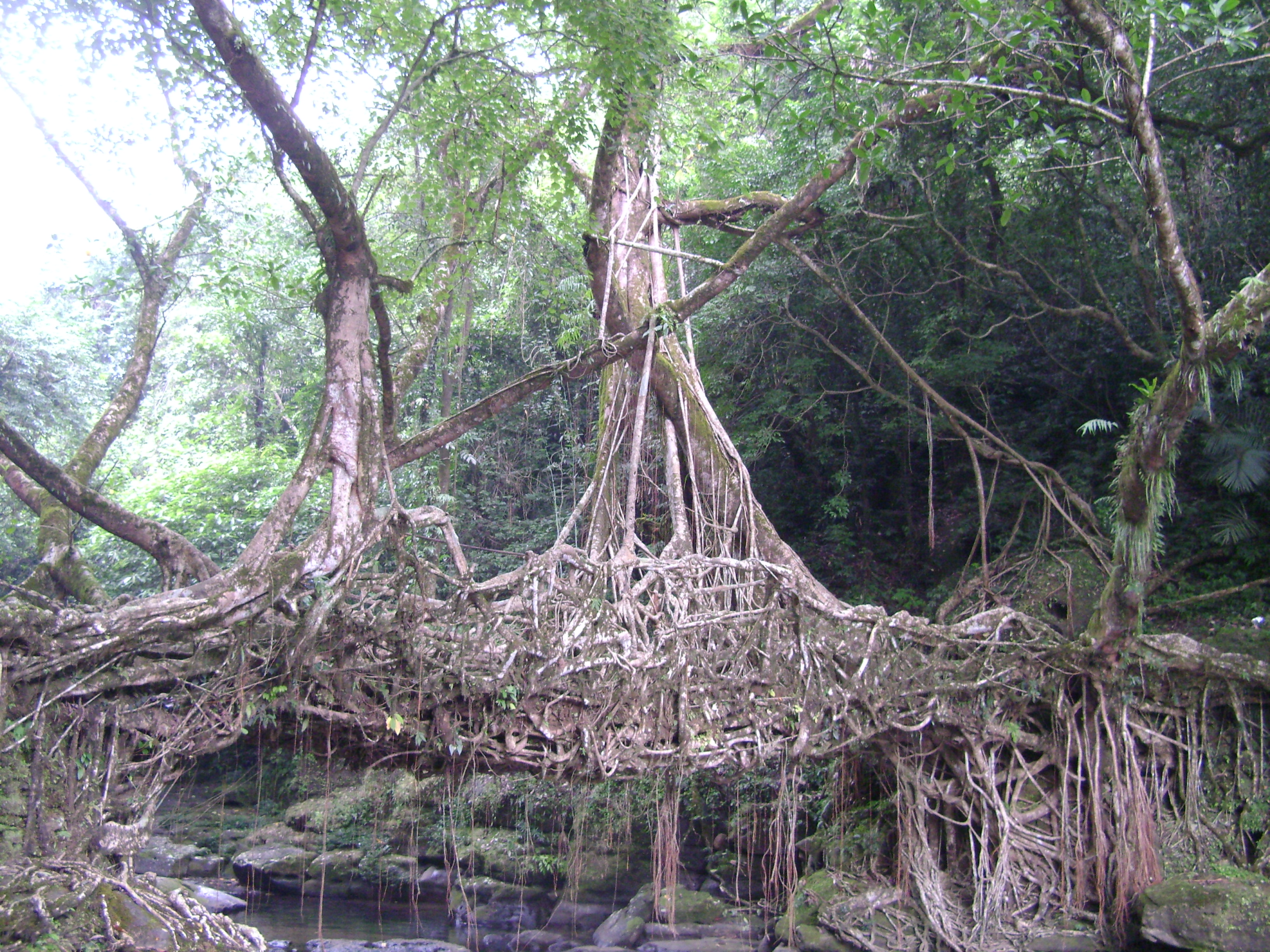
Here is the part that makes the region remarkable rather than merely wet. Steel rusts and timber and bamboo rot, fast, in warm air that is saturated for months at a time. A conventional footbridge over a monsoon stream in that climate has a short life and has to be rebuilt after the floods, which in that terrain means rebuilding it in exactly the conditions that destroyed it.
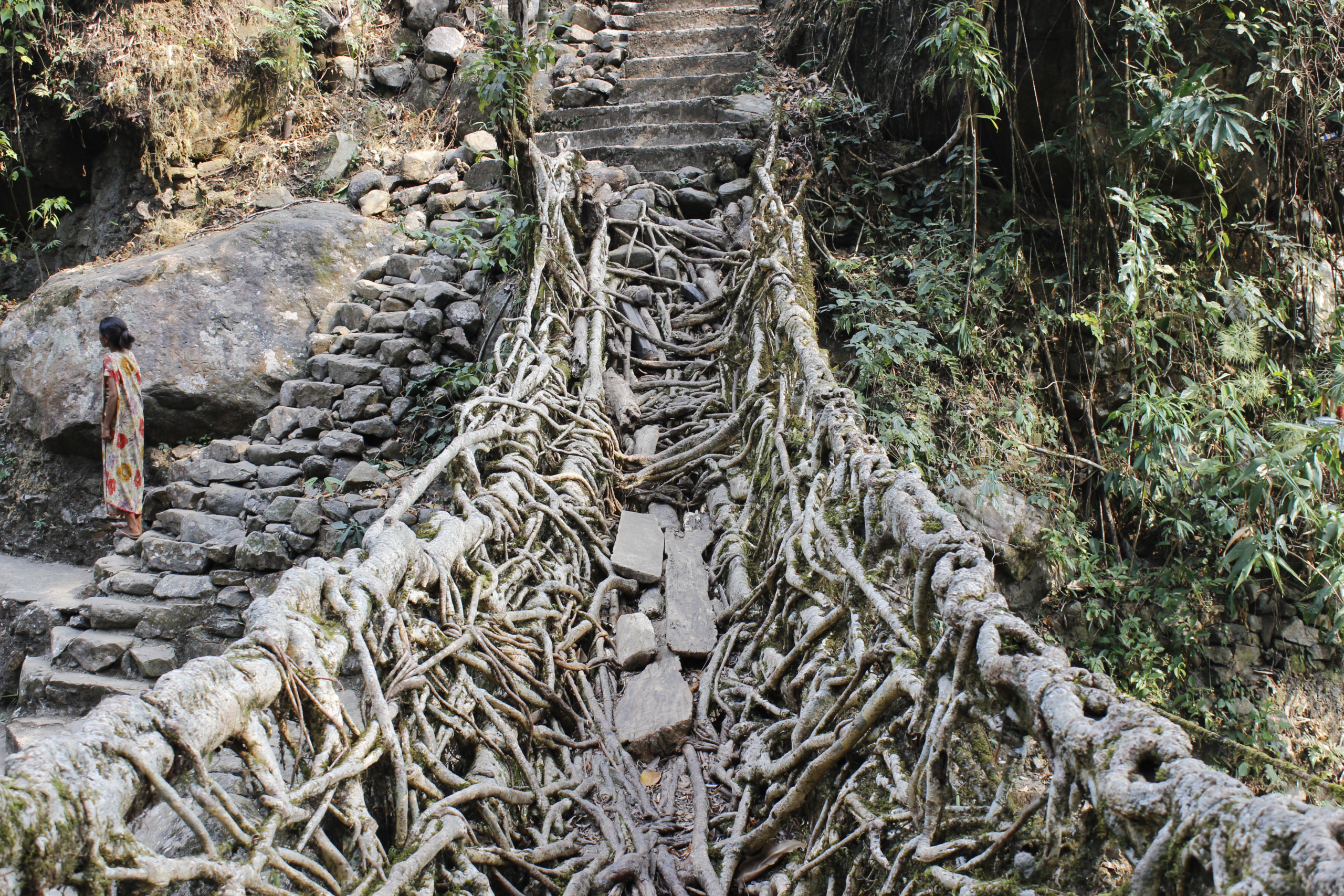
The Khasi solution is a bridge that is alive. Communities train the aerial roots of the rubber fig, Ficus elastica, across the stream, guiding them along scaffolds of bamboo or hollowed trunks until they reach the far bank and root there. Then they keep guiding them: more roots are led across, woven together, and over time they thicken, fuse and knit into a structural deck with handrails. The result is called a jingkieng jri, a living root bridge, and there are dozens of them in the hills.
What makes them work
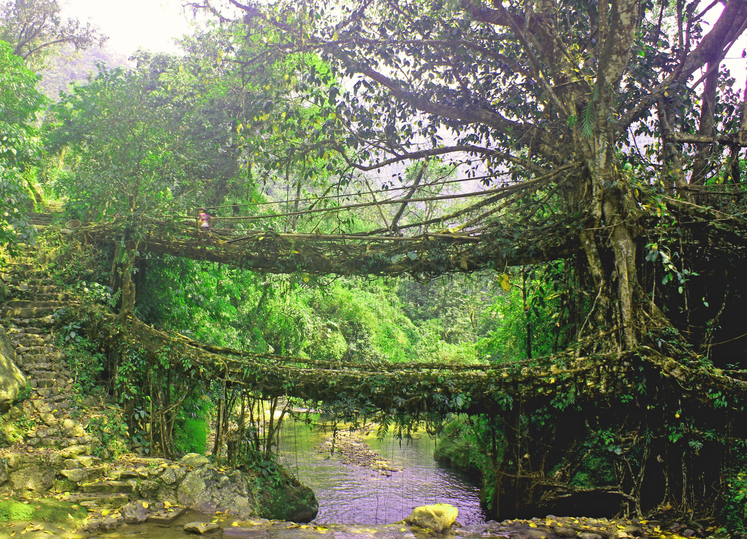
The engineering logic is the exact inverse of the usual kind, and it is worth stating plainly. A built structure is at its strongest the day it is finished and gets weaker from then on. A living bridge is at its weakest when it is new and gets stronger every year, because it is still growing. Roots respond to load by thickening. Damage heals. The structure is not resisting the climate; it is using it.
The cost is time. A bridge of useful size takes decades to become load-bearing, which means that the person who starts one will not be the person who uses it. That is the detail that tends to stay with people: these are structures built by one generation for a later one, maintained continuously by the village, with the knowledge of how to guide and splice the roots passed along as a practical skill. Some of the bridges in use today are understood locally to be well over a century old, and the older ones carry more weight than the younger ones do.
Living under that much rain

The ordinary adaptations are everywhere once you look. The traditional rain shield is a knup, a large shell of bamboo and leaves worn over the back and head, which leaves both hands free and sheds water better than anything held. Roofs are steep. Paths are stepped and paved with stone because an unpaved path becomes a stream. Houses are sited with drainage in mind rather than view.
And the rain is loud. On a corrugated metal roof in full monsoon it is loud enough to end conversation, and people who grew up there describe learning to wait out a squall mid-sentence as an ordinary social habit. School attendance, market days, farming and travel are all organised around a season in which several feet of water will fall, and the organising is so thorough that visitors arriving in the monsoon often report that the place seems unbothered, which it is, because the whole village is built for it.
Going there
The region is reached from Shillong, the state capital, and both of the record villages are a drive of a couple of hours from it on hill roads. The honest advice about timing is a genuine trade-off rather than a recommendation. Visit in the monsoon and you will see the thing the place is famous for, in the form of waterfalls coming off the escarpment in their hundreds and cloud filling the valleys, and you will see very little of it, because it will be inside the cloud and raining hard.
Visit in the dry months and the views across the plains of Bangladesh from the plateau edge are extraordinary and the bridges are easy walking, but the rain that explains everything will be absent. The bridges are in villages that are living places rather than sites, several of them reached by long stone stairways down into the gorges, and the communities that maintain them have in recent years had to manage genuinely heavy visitor numbers on structures that were grown for the use of a few dozen families.
That last point deserves taking seriously rather than treating as a caveat. A root bridge is not infrastructure that was built and handed over; it is a thing a village is still growing, and the maintenance is ongoing work done by people who live at the end of the path. Several of the communities now charge a small fee and limit numbers on the narrower crossings, which is a reasonable response to a structure designed around a load that nobody anticipated multiplying. The bridges are extraordinary and they are also somebody’s route to their fields.
Like our content? Follow us for more.