Most disasters happen fast. An earthquake gives you seconds; a flash flood, minutes. What happened to Thistle, Utah, took weeks — slow enough that residents carried their furniture out one load at a time, engineers measured the catastrophe with survey stakes, and the whole state watched a town die on the evening news at a pace of a few feet per day. Nobody was killed. Almost everything else was lost.
Drive U.S. Highway 6 through Spanish Fork Canyon today, about an hour south of Salt Lake City, and you can still see what’s left: a half-drowned house leaning out of the wetland, foundations in the willows, the ghost of a main street under water and silt. It’s one of the strangest roadside sights in the American West, and the story behind it is stranger still.
A Town Built Because the Railroad Needed to Breathe
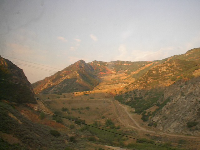
Thistle existed for one reason: gravity. The town sat at the junction where the Denver & Rio Grande Western’s main line, climbing toward the 7,400-foot Soldier Summit, met the branch line running south toward Sanpete County. Steam locomotives couldn’t make the grade alone, so Thistle was where helper engines — extra locomotives kept ready around the clock — coupled onto freight and passenger trains for the push over the mountain.
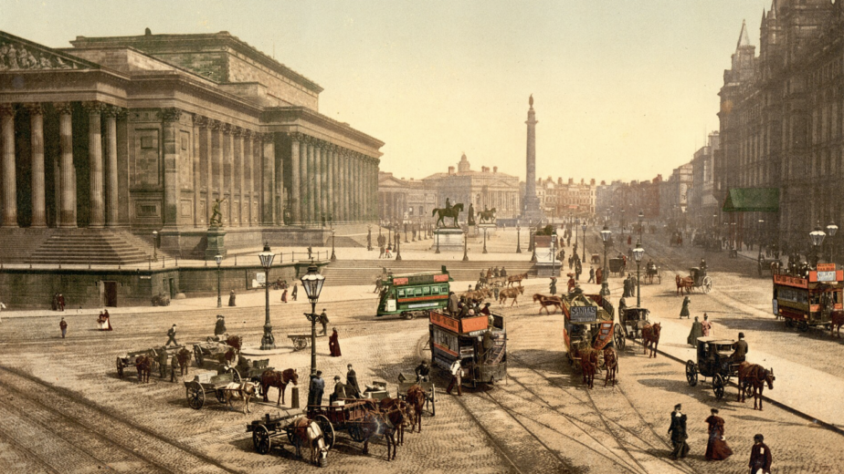
That job built a real town. At its peak in the early twentieth century, Thistle had around 600 people, a two-story schoolhouse, a depot, a roundhouse for servicing the helpers, saloons, boarding houses, and rows of railroad cottages along the Spanish Fork River. Passenger trains stopped daily. Kids grew up timing their lives to whistle schedules. It was the classic American railroad company town — modest, essential, and entirely dependent on one employer’s technology.
The technology moved on. Diesel locomotives, arriving after World War II, could climb Soldier Summit without help, and the railroad jobs dried up year by year. The depot closed in the 1970s. By the early 1980s, Thistle was down to a few dozen residents — families who stayed for the canyon, the quiet, and the houses their grandparents had built. Then the mountain moved.
Like our content? Follow us for more.
The Spring the Hillside Started Walking
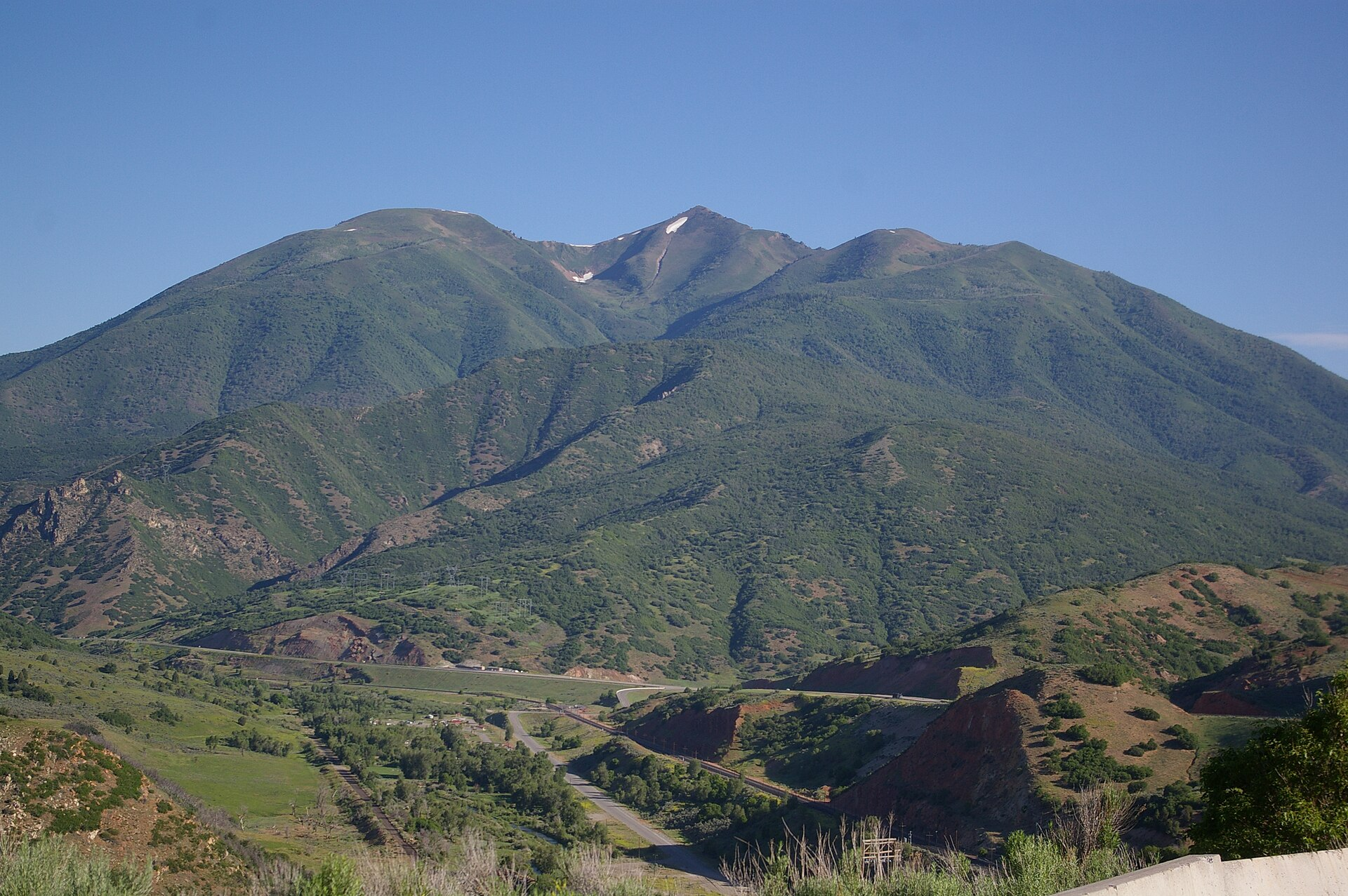
The winter of 1982–83 was one of the wettest on record in Utah — deep snowpack on top of a soaked autumn — and the canyon’s slopes, layered with ancient, unstable clays, drank all of it. In mid-April 1983, railroad crews noticed the tracks near Thistle kept bending out of alignment. They’d straighten them; the earth would bend them again by morning. Highway workers found the pavement of U.S. 6 buckling the same way.
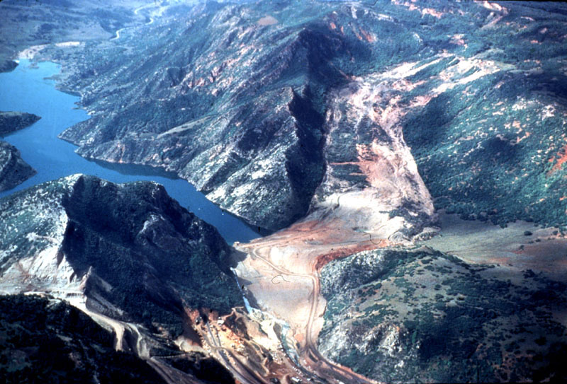
What they were standing on was the toe of an enormous landslide — millions of cubic yards of mountainside, saturated past its limit, creeping downhill as a single mass. It moved a few feet per day at first, then faster, and there was no stopping something that size. Within days it had shoved the highway and the rail line aside and kept going until it slammed into the opposite canyon wall, forming an earthen dam two hundred feet high across the Spanish Fork River.
Rivers don’t negotiate. With its outlet plugged, the Spanish Fork began backing up into the canyon — directly into Thistle. The water rose day after day through late April, and residents evacuated in the strangest way a disaster allows: with time. Families ferried out belongings by truck and boat as the lake climbed their porch steps, then their windows. The two-story schoolhouse went under to its roofline. By the time the water stopped rising, “Thistle Lake” was more than 160 feet deep, and the town that helper engines built was at the bottom of it.
The Most Expensive Landslide in American History
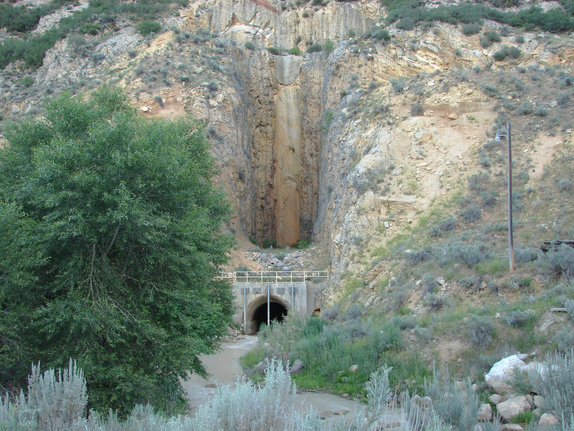
The dollar figures made Thistle nationally famous. The slide severed both U.S. Highway 6 and the Denver & Rio Grande’s transcontinental main line — the railroad’s only route through the Wasatch — halting rail traffic for months and forcing one of the fastest heavy-construction responses of the era. Crews bored a tunnel through solid rock to carry the railroad around the slide, blasted a new highway alignment high across the canyon wall, and drilled drainage tunnels to drain the accidental lake before the unstable natural dam could fail catastrophically downstream.
Add it up — the rerouting, the tunneling, the lost commerce, the drowned town — and total costs ran to roughly $200 million in 1983 dollars, several times that in today’s money. Thistle is routinely cited as the most expensive landslide in United States history, and it earned a second distinction: it prompted Utah’s first federally declared disaster area. All of that, and the slide never took a single life — a function of its merciless slowness, which destroyed everything and hurried no one.
What You Can See From the Highway Today
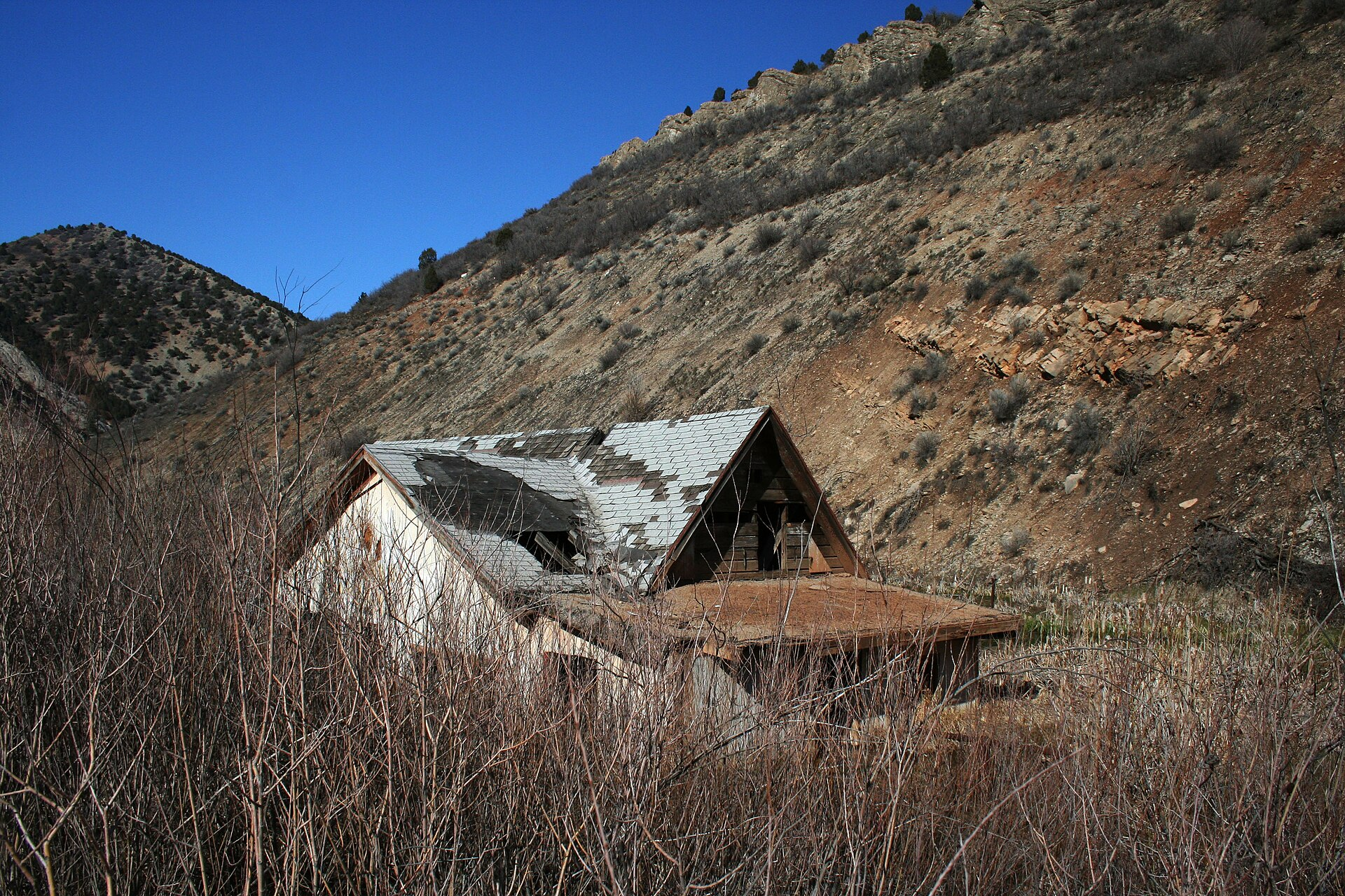
The lake is mostly gone — engineers drained it once the bypass tunnels were secure — but the town never came back. What the receding water left is the Thistle you can see now: a marshy valley floor where the river braids through willows, and rising out of it, the famous half-collapsed house that has become one of Utah’s most photographed ruins, its gabled roof and empty windows tilted at the angle the flood left them. Concrete foundations, cellar holes, and fragments of the old alignment surface here and there among the reeds.
The viewing is easy and free. U.S. 6 between Spanish Fork and Price runs right past the site, and pullouts near the slide area let you stop safely — which matters, because Highway 6 is busy and not a road for improvised parking. The ruins themselves sit on private and railroad land in unstable, marshy ground; this is a look-don’t-touch site, best appreciated through a camera zoom. Trains still roll through the canyon on the post-slide alignment, which adds a nice touch: the railroad that created Thistle now runs past its grave several times a day.
The Slide Isn’t Finished
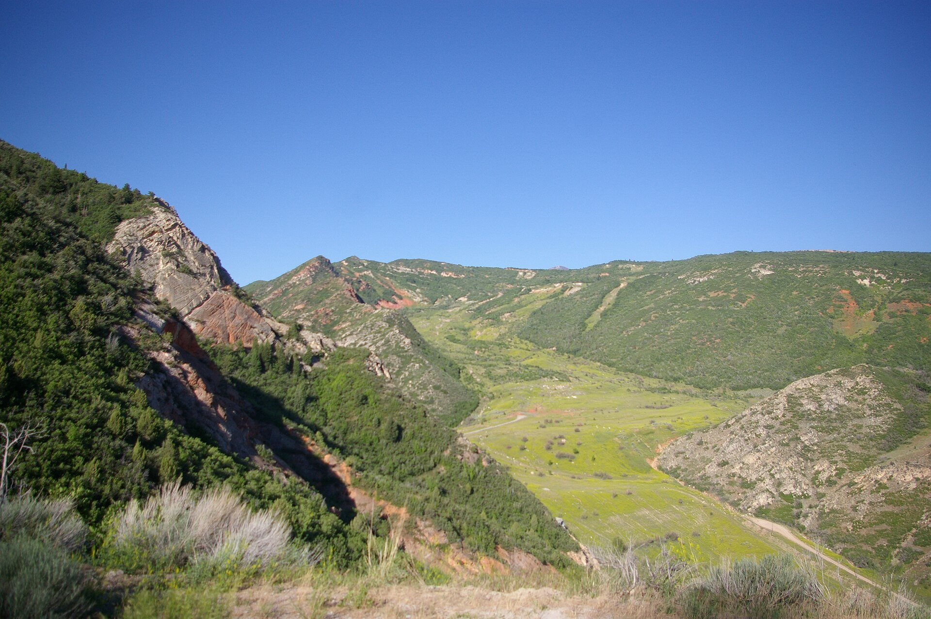
Here’s the detail that keeps geologists interested: the Thistle landslide never really stopped. The mass still creeps measurably in wet years, and it has been monitored continuously for four decades — instruments in the hillside, survey benchmarks, the whole apparatus of watching a mountain think about moving again. The 1983 event turned the site into one of the most studied landslides in North America, a full-scale laboratory that has shaped how highway departments across the West evaluate slopes above their roads.
For visitors, that ongoing motion is invisible; the canyon looks serene, which is exactly how it looked in March 1983. The lesson locals took from Thistle is the one the landscape teaches everywhere in Utah: the ground has opinions, and it doesn’t announce them.
Making the Trip
Thistle works best as a stop rather than a destination — fifteen minutes of walking the pullout, photographing the drowned house, and reading the canyon — folded into one of central Utah’s better drives. Continue southeast on U.S. 6 and you’re on the route toward Helper (a town literally named for those same helper engines, with an excellent mining-and-railroad museum) and eventually the canyon country around Price. Head the other way and you’re thirty minutes from Provo. History-minded travelers can pair it with Soldier Summit itself, where informal pullouts mark the grade that made Thistle necessary in the first place.
Go in late afternoon if you can, ideally on a weekday when the coal and freight traffic through the canyon is steady. The light comes down the canyon lengthwise, the marsh turns gold, and the old house throws a long shadow across the water that erased its town — slowly, patiently, while everyone watched.
Thistle also changed how the West watches its mountains. The slide became a founding case study for landslide-hazard programs across the region — Utah stood up a formal geological hazards effort in its aftermath, and transportation departments from Colorado to California cite the canyon when they instrument slopes above highways today. The disaster’s real legacy isn’t the drowned house; it’s the network of sensors on hillsides across the West that exists so no state has to watch a town go under in slow motion again.
For photographers, a practical note: the famous leaning house sits east of the highway near the slide area, and the best images come from the marked pullouts with a zoom lens in low-angle light. Morning fog off the wetland can be spectacular in fall, and the passing freight trains on the relocated line, timed right, put motion and scale into a frame that’s otherwise all stillness and ruin. Resist the urge to walk in — beyond the private-land problem, the valley floor is true marsh, soft enough to swallow a boot, which is somehow a fitting security system for a town the ground already took once.
Like our content? Follow us for more.